
IMAGES TAKEN NEAR TO
Honeybourne Crescent, BOURNEMOUTH, BH6 4JD
Introduction
This page details the photographs taken nearby to Honeybourne Crescent, BH6 4JD by members of the Geograph project.
The Geograph project started in 2005 with the aim of publishing, organising and preserving representative images for every square kilometre of Great Britain, Ireland and the Isle of Man.

There are currently over 7.5m images from over14,400 individuals and you can help contribute to the project by visiting https://www.geograph.org.uk
Image Map
Images are licensed for reuse under creativecommons.org/licenses/by-sa/2.0
Notes
- Clicking on the map will re-center to the selected point.
- The higher the marker number, the further away the image location is from the centre of the postcode.
Image Listing (50 Images Found)
Images are licensed for reuse under creativecommons.org/licenses/by-sa/2.0
Image
Details
Distance
1
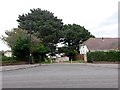
Wick: footpath I29 from Verwood Crescent
The kerb of Verwood Crescent opens out like a side turning here, at the point where this public footpath to Ariel Drive starts. It is a short grass-flanked path.
See Image for a photo of the path as it descends just ahead.
Image: © Chris Downer
Taken: 24 Sep 2016
0.06 miles
2
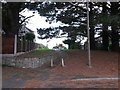
Wick: footpath I29 leaves Ariel Drive
Looking up this short public footpath from the dead end of Ariel Drive - the path follows an extension of the course of Ariel Drive, up the little bank to Verwood Crescent.
See Image for the view towards us from midway up the hill, and Image for a wider view from behind us.
Image: © Chris Downer
Taken: 24 Sep 2016
0.07 miles
3
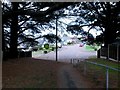
Wick: footpath I29 descends to Ariel Drive
This short public footpath leads down from Verwood Crescent to the dead end of Ariel Drive, which we see just ahead.
See Image for the view from behind us in Verwood Crescent, and Image for the uphill view from the road ahead.
Image: © Chris Downer
Taken: 24 Sep 2016
0.07 miles
4
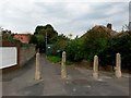
Wick: bridleway I28 has a No Cycling sign
This is the start of the public right of way leading to Branders Close. It is, according to all relevant maps (including data from the Local Authority's definitive map), designated as a public bridleway.
However, it has a No Cycling sign at this end, which would be appropriate if this were a public footpath rather than a public bridleway. The red perimeter circle of the sign has faded almost to non-existence and is on a substantially rusting pole, suggesting that it has been there very many years.
See Image] for the next photo along the bridleway, with links to further photos along the route.
Image: © Chris Downer
Taken: 24 Sep 2016
0.07 miles
5
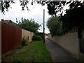
Wick: towards the southern end of bridleway I28
This short bridleway is more footpath-like and it runs between the dead end of Branders Close (behind us) and Thornbury Road. We see it as it approaches the latter, with some green utility box ahead on the grass abutting the path.
See Image for the next view along the path ahead, and Image for the next behind us, with links to further photos along the route.
Image: © Chris Downer
Taken: 24 Sep 2016
0.08 miles
6
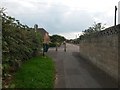
Wick: bridleway I28 emerges onto Thornbury Road
Looking along the southern end of this short public bridleway from Branders Close, as it arrives onto Thornbury Road. Belfield Road is directly opposite - well, a yard or two off-straight.
See Image] for the view towards us from the end of the bridleway, and Image for the next view on the path behind us, with links to further pictures along the route.
Image: © Chris Downer
Taken: 24 Sep 2016
0.08 miles
7
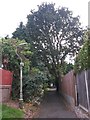
Wick: lamppost on bridleway I28
This short bridleway is more footpath-like and it runs between the dead end of Branders Close (behind us) and Thornbury Road. The left-hand side as we look has a grass/vegetated strip all along its length.
See Image for the next view along the path ahead, and Image for the next behind us - each with links to further photos along the route.
Image: © Chris Downer
Taken: 24 Sep 2016
0.08 miles
8
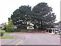
Wick: the dead end of Ariel Drive
The road comes to an abrupt end but a public footpath continues up the little bank to Verwood Crescent.
See Image for a view from the bottom of the footpath, and links to further pictures on the path.
Image: © Chris Downer
Taken: 24 Sep 2016
0.08 miles
9
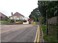
Wick: bridleway I28 from Branders Close
This short public bridleway leads from the dead end of Branders Close to Thornbury Road, and as can be seen here it resembles a footpath more than a bridleway.
See Image for the next view along the bridleway, with links to further photos along the route.
Image: © Chris Downer
Taken: 24 Sep 2016
0.09 miles
10
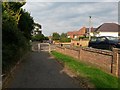
Wick: emerging onto Branders Close from bridleway I28
This short bridleway is more footpath-like and it runs between the dead end of Branders Close (just here) and Thornbury Road. The right-hand side as we look has a grass/vegetated strip all along its length.
See Image for the view up the path from ahead, and Image for the next behind us, with links to further photos along the route.
Image: © Chris Downer
Taken: 24 Sep 2016
0.10 miles