Wick: bridleway I28 has a No Cycling sign
Introduction
The photograph on this page of Wick: bridleway I28 has a No Cycling sign by Chris Downer as part of the Geograph project.
The Geograph project started in 2005 with the aim of publishing, organising and preserving representative images for every square kilometre of Great Britain, Ireland and the Isle of Man.

There are currently over 7.5m images from over 14,400 individuals and you can help contribute to the project by visiting https://www.geograph.org.uk
Wick: bridleway I28 has a No Cycling sign
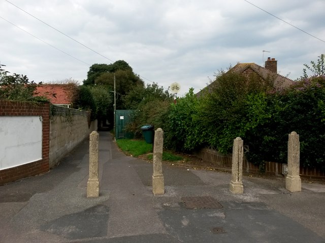
Image: © Chris Downer Taken: 24 Sep 2016
This is the start of the public right of way leading to Branders Close. It is, according to all relevant maps (including data from the Local Authority's definitive map), designated as a public bridleway. However, it has a No Cycling sign at this end, which would be appropriate if this were a public footpath rather than a public bridleway. The red perimeter circle of the sign has faded almost to non-existence and is on a substantially rusting pole, suggesting that it has been there very many years. See Image] for the next photo along the bridleway, with links to further photos along the route.
Images are licensed for reuse under creativecommons.org/licenses/by-sa/2.0
Image Location
Latitude
50.726161
Longitude
-1.784034