
IMAGES TAKEN NEAR TO
Tiller Gardens, BOURNEMOUTH, BH11 9AT
Introduction
This page details the photographs taken nearby to Tiller Gardens, BH11 9AT by members of the Geograph project.
The Geograph project started in 2005 with the aim of publishing, organising and preserving representative images for every square kilometre of Great Britain, Ireland and the Isle of Man.

There are currently over 7.5m images from over14,400 individuals and you can help contribute to the project by visiting https://www.geograph.org.uk
Image Map
Images are licensed for reuse under creativecommons.org/licenses/by-sa/2.0
Notes
- Clicking on the map will re-center to the selected point.
- The higher the marker number, the further away the image location is from the centre of the postcode.
Image Listing (70 Images Found)
Images are licensed for reuse under creativecommons.org/licenses/by-sa/2.0
Image
Details
Distance
1
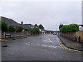
Kinson: Westdown Road
This ordinary looking road is marked on the map as a 'Byway open to all traffic' and is numbered E29 on Bournemouth Borough Council's definitive map of public rights of way.
I don't know why this particular stretch of road should be labelled as such: maybe it was a historical route when this was heathland, and the modern road network incorporated it. This suggestion is perhaps supported by the historical 1:25,000 maps, which date from when Durdells Avenue (where we are) was the first built-up road as the construction of the estate started. On this map, Westdown Road was the only offshoot of Durdells Avenue, beyond which it was still fields.
The definitive map seems to show the right of way as extending only as far as number 9, the fourth house along - that's about two thirds of the length of the road. See Image] for a view towards us from about there.
Image: © Chris Downer
Taken: 29 Jun 2016
0.04 miles
2
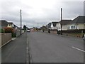
Kinson: looking southwest along Westdown Road
This ordinary looking road is marked on the map as a 'Byway open to all traffic' and is numbered E29 on Bournemouth Borough Council's definitive map of public rights of way.
I don't know why this particular stretch of road should be labelled as such: maybe it was a historical route when this was heathland, and the modern road network incorporated it. This suggestion is perhaps supported by the historical 1:25,000 maps, which date from when Durdells Avenue (ahead) was the first built-up road as the construction of the estate started. On this map, Westdown Road was the only offshoot of Durdells Avenue, beyond which it was still fields.
The definitive map seems to show the right of way as extending towards us only as far as roughly alongside where we are standing now - that's about two thirds of the length of the road.
See Image for the view along the road from the far end.
Image: © Chris Downer
Taken: 18 Mar 2017
0.04 miles
3
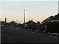
West Howe: postbox № BH11 374, Durdells Avenue
An Elizabeth II-reign postbox near the southern end of Durdells Avenue, where it meets Poole Lane.
Image: © Chris Downer
Taken: 7 Dec 2008
0.07 miles
4
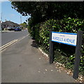
Kinson: Durdells Avenue
Durdells Avenue runs across the northwest corner of the West Howe council estate and may well have been the route of an original track between Poole Lane and Wimborne Road, before the area was built up. It contains mainly council bungalows at this southeast end, and private bungalows in the northwest half.
The sign is a modern one, from 2010-15 when this more modern, abstract emblem rather than the traditional town coat of arms as the working logo of the council.
This is photo no.120 of a series of 453 in my coronavirus lockdown walking project:
See https://www.geograph.org.uk/article/My-2020-Coronavirus-Lockdown-walking-project for the complete set of photos.
Image: © Chris Downer
Taken: 13 Apr 2020
0.08 miles
5
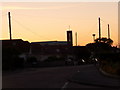
Kinson: Christ the King in silhouette
The Catholic church serving the northern suburbs of Bournemouth poses a striking silhouette as we look along Durdells Avenue late on a perfect summer's evening.
Image: © Chris Downer
Taken: 15 Jun 2010
0.08 miles
6
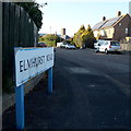
West Howe: Elmhurst Road
Looking along this short road on the northern fringe of the large 1950s West Howe housing estate. The houses are typical council semis and in recent years energy has been garnered from the installation of photovoltaic cells on their roofs.
The sign is of a design that became prevalent in Bournemouth around 1990 and was in use for most of that decade. Many are starting to look a bit shabby now, and the blue border is faded on this one.
This is photo no.129 of a series of 453 in my coronavirus lockdown walking project:
See https://www.geograph.org.uk/article/My-2020-Coronavirus-Lockdown-walking-project for the complete set of photos.
Image: © Chris Downer
Taken: 16 Apr 2020
0.09 miles
7
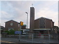
West Howe: Catholic church of Christ the King
The Catholic church serving northwest Bournemouth stands here in Durdells Avenue. The associated primary school is along a driveway just out of picture to the right.
Image: © Chris Downer
Taken: 21 Jun 2014
0.09 miles
8

Kinson: footpath E13 from Wakely Road
This public footpath cuts through to the main Poole Lane, a useful cut-through towards the centre of Kinson. See Image for a nighttime view midway along the path, with links to further pictures on the route.
Image: © Chris Downer
Taken: 29 Jun 2016
0.09 miles
9
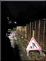
West Howe: roadworks sign on footpath E13
Despite it being 11:20pm, the roadworks sign is visible almost to daytime levels thanks to the excellent lighting on this short public footpath. The sign refers to a slight narrowing of the path ahead, part of more major work involving temporary traffic lights on Poole Lane, just ahead.
See Image for the view along the path from the end behind us, and Image for the view towards us from along the path ahead, and a link to further photos through to the end.
Image: © Chris Downer
Taken: 1 Feb 2017
0.09 miles
10

Kinson: footpath E13 to Wakely Road
Alongside two houses that are set back from the road runs this useful cut-through - see Image] for a nighttime view and links to further photos through to the other end.
In front of the houses runs another footpath - see Image
Image: © Chris Downer
Taken: 29 Jun 2016
0.10 miles