
IMAGES TAKEN NEAR TO
Lightfoots Close, SCARBOROUGH, YO12 5NR
Introduction
This page details the photographs taken nearby to Lightfoots Close, YO12 5NR by members of the Geograph project.
The Geograph project started in 2005 with the aim of publishing, organising and preserving representative images for every square kilometre of Great Britain, Ireland and the Isle of Man.

There are currently over 7.5m images from over14,400 individuals and you can help contribute to the project by visiting https://www.geograph.org.uk
Image Map
Images are licensed for reuse under creativecommons.org/licenses/by-sa/2.0
Notes
- Clicking on the map will re-center to the selected point.
- The higher the marker number, the further away the image location is from the centre of the postcode.
Image Listing (15 Images Found)
Images are licensed for reuse under creativecommons.org/licenses/by-sa/2.0
Image
Details
Distance
1
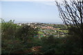
Sandybed from The Mount
Taken from the public footpath which crosses below the wooded slopes of The Mount, Sandybed allotments can be seen, with a residential estate of red brick houses beyond. Striking up the hill in the middle distance can be seen the white gables of the post war 'pre-fabs' shown in Image
Image: © Christopher Hall
Taken: 4 Mar 2013
0.05 miles
2
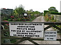
Sandybed Allotments, Lightfoots Road, Scarborough
Image: © David Rogers
Taken: 7 Oct 2009
0.08 miles
3
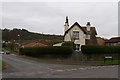
Sandybed Lane junction
This is the junction between Sandybed Lane, Springhill Lane, Lightfoots Lane and Lightfoots Road. The name Sandybed is descriptive of the ground conditions in this area and Springill Lane reflects the spring line to the east.
The fairly recent houses to the extreme right are on the site of the former Royal Navy radio station, founded in 1914.
Image: © Christopher Hall
Taken: 28 Nov 2013
0.09 miles
4
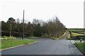
Cross Lanes, Sandybed, Scarborough
Taken from Sandybed Lane, the road becomes a track beyond the no through road sign from where it is named Lightfoot's Lane. Going off to the left is Spring Hill Lane, from where Image and Image are taken, whilst to the right is Lightfoot's Road. The track to the left of, and parallel to Lightfoot's Lane leads to allotments and the break in the hedge to the left of this is where a footpath goes off up to Falsgrave Park; see Image
Image: © Christopher Hall
Taken: 10 Jan 2014
0.11 miles
5
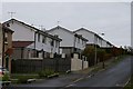
BISF houses in Springhill Lane
These system built houses are a type known as the BISF house. They are a steel framed post-war house, designed and produced by the British Iron and Steel Federation, and erected around the country from 1946 to the early 1950s.They conform to a design concept by architect Sir Frederick Gibberd. They are not pre-fabs but a permanent system built house designed to help cope with the post war housing shortage. These in Springhill Lane have been re-clad and refurbished in recent years.
Image: © Christopher Hall
Taken: 28 Nov 2013
0.13 miles
6
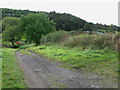
Lightfoots Track, Scarborough
Approaching Jacob's Ladder from Cross Lanes.
Image: © David Rogers
Taken: 7 Oct 2009
0.15 miles
7
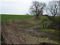
Farm Track to Sandybed from Falsgrave Moor
Image: © Martin Dawes
Taken: 30 Dec 2008
0.15 miles
8
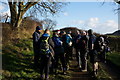
Checkpoint 5 on Scarborough Rock 2015
Taken while sweeping the Scarborough Rock Challenge Walk.
Image: © Ian S
Taken: 10 Jan 2015
0.16 miles
9
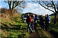
Checkpoint 5 on Scarborough Rock 2015
Taken while sweeping the Scarborough Rock Challenge Walk.
Image: © Ian S
Taken: 10 Jan 2015
0.16 miles
10
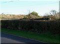
Springhill Lane
Just above the hedge can be seen the top of a World War II pill box. This was sited to give protective cover to the Royal Navy radio station in Sandybed Lane at the foot of the hill.
the fenced flat area in the background is Springhill Reservoir opened in 1928 to augment the town's water supply at a time when new developments were taking place. Water is pumped to here from Irton Waterworks.
Image: © Christopher Hall
Taken: 30 Nov 2013
0.17 miles