Sandybed from The Mount
Introduction
The photograph on this page of Sandybed from The Mount by Christopher Hall as part of the Geograph project.
The Geograph project started in 2005 with the aim of publishing, organising and preserving representative images for every square kilometre of Great Britain, Ireland and the Isle of Man.

There are currently over 7.5m images from over 14,400 individuals and you can help contribute to the project by visiting https://www.geograph.org.uk
Sandybed from The Mount
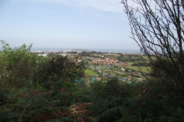
Image: © Christopher Hall Taken: 4 Mar 2013
Taken from the public footpath which crosses below the wooded slopes of The Mount, Sandybed allotments can be seen, with a residential estate of red brick houses beyond. Striking up the hill in the middle distance can be seen the white gables of the post war 'pre-fabs' shown in Image
Images are licensed for reuse under creativecommons.org/licenses/by-sa/2.0
Image Location


Leaflet Map data © OpenStreetMap
Latitude
54.271706
Longitude
-0.426594