
IMAGES TAKEN NEAR TO
London Road, PULBOROUGH, RH20 3BT
Introduction
This page details the photographs taken nearby to London Road, RH20 3BT by members of the Geograph project.
The Geograph project started in 2005 with the aim of publishing, organising and preserving representative images for every square kilometre of Great Britain, Ireland and the Isle of Man.

There are currently over 7.5m images from over14,400 individuals and you can help contribute to the project by visiting https://www.geograph.org.uk
Image Map
Images are licensed for reuse under creativecommons.org/licenses/by-sa/2.0
Notes
- Clicking on the map will re-center to the selected point.
- The higher the marker number, the further away the image location is from the centre of the postcode.
Image Listing (22 Images Found)
Images are licensed for reuse under creativecommons.org/licenses/by-sa/2.0
Image
Details
Distance
1
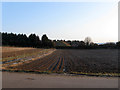
Town Field
The name of the field according to Ashington's 1847 tithe map that is now a market garden. Part of the eastern end adjacent to the old course of the A24 has also been lost to business units.
Image: © Simon Carey
Taken: 2 Apr 2013
0.05 miles
2
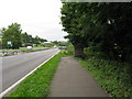
View north of the A24 southbound carriageway
Image: © Dave Spicer
Taken: 1 Aug 2009
0.11 miles
3
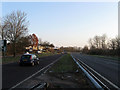
London Road
This section of the A24 was made a dual carriageway in the 1960s obliterating Spring Cottages in the process. To the left is Wiston Business Park which can be accessed by the old course of the road.
Image: © Simon Carey
Taken: 2 Apr 2013
0.11 miles
4
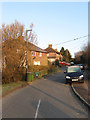
Spring Gardens (1)
Small estate built during the 1930s just off the A24. See also Image
Image: © Simon Carey
Taken: 2 Apr 2013
0.11 miles
5
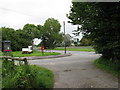
Footpath joining Spring Gardens
Which in turn joins minor road which joins the A24
Image: © Dave Spicer
Taken: 1 Aug 2009
0.12 miles
6
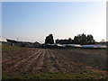
Legg Four Acres
The name of the field according to Washington's 1839 tithe map that is now part of Spring Garden Nurseries whose outbuildings and glasshouses can be seen on the far side of the small field.
Image: © Simon Carey
Taken: 2 Apr 2013
0.14 miles
7
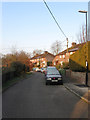
Spring Gardens (2)
Small estate built in the 1930s off the A24. See also Image
Image: © Simon Carey
Taken: 2 Apr 2013
0.14 miles
8
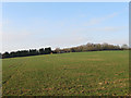
Great Town Field/Town Field/High Park/Mitchbourne Field
The name of the fields according to Ashington's 1847 tithe map that have been joined together to make a larger unit. Great Town Field ran east to west in the foreground with part of that field lost to Wiston Business park. Beyond on the slope was Town Field which has also lost part of its area to the aforementioned business park. At the far end to the right was High Park which has also lost land in the last thirty years to Springfield, the house in view. Lastly, on the immediate right was Mitchbourne Field
Image: © Simon Carey
Taken: 2 Apr 2013
0.14 miles
9
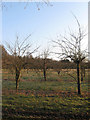
Elm Field
The name of the field according to Washington's 1839 tithe map that is now an orchard belonging to Spring Garden Nurseries. Viewed from the footpath that links the A24 to Rock Road.
Image: © Simon Carey
Taken: 2 Apr 2013
0.16 miles
10
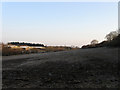
Peters Mead/Great Bridge Field
The name of the field according to Ashington's 1847 tithe map which have been joined together to form a larger unit. Peters Mead was in the foreground and Great Bridge Field lay in the distance and currently borders the modern A24. On the far side of that is Wiston Business Estate.
Image: © Simon Carey
Taken: 2 Apr 2013
0.17 miles