
IMAGES TAKEN NEAR TO
Coleshill Road, NUNEATON, CV10 0NY
Introduction
This page details the photographs taken nearby to Coleshill Road, CV10 0NY by members of the Geograph project.
The Geograph project started in 2005 with the aim of publishing, organising and preserving representative images for every square kilometre of Great Britain, Ireland and the Isle of Man.

There are currently over 7.5m images from over14,400 individuals and you can help contribute to the project by visiting https://www.geograph.org.uk
Image Map
Images are licensed for reuse under creativecommons.org/licenses/by-sa/2.0
Notes
- Clicking on the map will re-center to the selected point.
- The higher the marker number, the further away the image location is from the centre of the postcode.
Image Listing (16 Images Found)
Images are licensed for reuse under creativecommons.org/licenses/by-sa/2.0
Image
Details
Distance
1
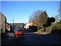
Coleshill Road, Chapel End
Looking along Coleshill Road as it descends from Chapel End towards Ansley Common.
Image: © Richard Vince
Taken: 2 Feb 2013
0.03 miles
2
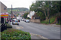
Coleshill Road, Chapel End
Coleshill Road leads down from the junction with Bucks Hill and Victoria Road at Chapel End with a distant view of open countryside. This is a stretch of the B4114.
Image: © Stephen McKay
Taken: 2 Nov 2022
0.03 miles
3
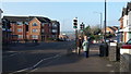
Chapel End
The B4114 is photographed at Chapel End, Nuneaton.
Image: © Peter Mackenzie
Taken: 13 Feb 2017
0.06 miles
4
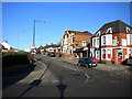
South end of Victoria Road, Hartshill
Despite looking like a suburban side street, Victoria Road is the main road into Hartshill from the south, at least for buses.
Image: © Richard Vince
Taken: 2 Feb 2013
0.06 miles
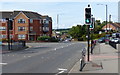
6
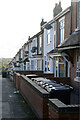
Bucks Hill, Chapel End
Looking down along a row of terraced houses from the top of Bucks Hill. Satellite dishes are much in evidence and the house in the foreground appears to have an extraordinary collection of wheely bins.
Image: © Stephen McKay
Taken: 9 Nov 2022
0.07 miles
7
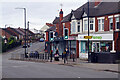
Camp Hill Road, Chapel End
Chapel End is a fairly drab area of Nuneaton although there are some useful shops here including the Lloyds pharmacy seen here. Victoria Road heads up the hill towards Hartshill.
Image: © Stephen McKay
Taken: 2 Nov 2022
0.07 miles
8
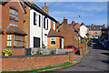
Chancery Lane, Chapel End
Chancery Lane forms a crescent to the south of Coleshill Road. This is the southernmost point.
Image: © Stephen McKay
Taken: 9 Nov 2022
0.08 miles
10
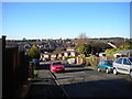
Salisbury Drive, Chapel End
Looking down Salisbury Drive from Buck's Hill, across the undulating suburban landscape of Nuneaton's western extremities.
Image: © Richard Vince
Taken: 2 Feb 2013
0.09 miles