IMAGES TAKEN NEAR TO
Forestry Road, MOLD, CH7 5SH

Introduction

This page details the photographs taken nearby to Forestry Road, CH7 5SH by members of the Geograph project.

The Geograph project started in 2005 with the aim of publishing, organising and preserving representative images for every square kilometre of Great Britain, Ireland and the Isle of Man.

There are currently over 7.5m images from over14,400 individuals and you can help contribute to the project by visiting https://www.geograph.org.uk

Image Map


Images are licensed for reuse under creativecommons.org/licenses/by-sa/2.0
Notes
  • Clicking on the map will re-center to the selected point.
  • The higher the marker number, the further away the image location is from the centre of the postcode.

Image Listing (17 Images Found)

Images are licensed for reuse under creativecommons.org/licenses/by-sa/2.0
Image
Details
Distance
1
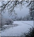
Access track to Fron Hen near Llanferres
An upland track in winter, curving up the hillside through plantation and large sheep pastures.
Image: © Jeremy Bolwell Taken: 19 Feb 2012
0.08 miles
2
Bench mark on Tyn y Groesffordd, Llanferres
This Ordnance Survey benchmark is on the north east corner of Tyn y Groesffordd, below Fron Hen, Llanferres. When the cottage was rendered the cut mark was left clear and then painted to highlight it. For a wider view see Image
Image: © John S Turner Taken: 29 Sep 2018
0.08 miles
3
View across the valley
The view across the valley from the bridleway around Fron Hen. The stream in the valley rises near Bwlch pen Barras and flows east to join the Afon Alun that flows through Loggerheads.
Image: © John S Turner Taken: 8 Apr 2009
0.10 miles
4
Bridleway below Fron Hen
Looking along the bridleway to the valley below and Coed Moel Famau. The road in the valley heads left towards Bwlch pen Barras and right towards Tafarn y Gelyn.
Image: © John S Turner Taken: 8 Apr 2009
0.10 miles
5
Farmland below Fron Hen
Pasture land below Fron Hen and next to the stream that flows down the valley from Bwlch pen Barras.
Image: © John S Turner Taken: 8 Apr 2009
0.11 miles
6
Fron Hen
From the roadside looking up towards Fron Hen
Image: © Dot Potter Taken: Unknown
0.11 miles
7
Dry stone wall below Fron Hen, Llanferres
This dry stone wall below Fron Hen has collapsed, and the large stone with the Ordnance Survey bench mark to the right of the hole may soon go the same way - Image
Image: © John S Turner Taken: 29 Sep 2018
0.12 miles
8
Bench mark below Fron Hen, Llanferres
This Ordnance Survey bench mark is cut into a dry stone wall alongside a track below Fron Hen. The wall to the left has collapsed, so the cut mark may soon go the same way - Image
Image: © John S Turner Taken: 29 Sep 2018
0.13 miles
9
View over Fron Hen farm
The view from the bridleway around Fron Hen across the Afon Alun valley. From this distance the main road between Mold and Ruthin is almost lost in the landscape.
Image: © John S Turner Taken: 8 Apr 2009
0.14 miles
10
Track below Fron Hen
A view from the old trackway that skirts around Fron Hen. The houses in the valley are alongside the road that heads towards Bwlch pen Barras; Coed Moel Famau is behind the houses. The flat stone at the very end of the stone wall carries a rivet bench mark - see Image
Image: © John S Turner Taken: 24 Jun 2009
0.16 miles