
IMAGES TAKEN NEAR TO
Glynn Road, PEACEHAVEN, BN10 8AP
Introduction
This page details the photographs taken nearby to Glynn Road, BN10 8AP by members of the Geograph project.
The Geograph project started in 2005 with the aim of publishing, organising and preserving representative images for every square kilometre of Great Britain, Ireland and the Isle of Man.

There are currently over 7.5m images from over14,400 individuals and you can help contribute to the project by visiting https://www.geograph.org.uk
Image Map
Images are licensed for reuse under creativecommons.org/licenses/by-sa/2.0
Notes
- Clicking on the map will re-center to the selected point.
- The higher the marker number, the further away the image location is from the centre of the postcode.
Image Listing (16 Images Found)
Images are licensed for reuse under creativecommons.org/licenses/by-sa/2.0
Image
Details
Distance
1
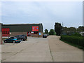
Business Units, Lower Hoddern Farm
Viewed from the entrance off Pelham Rise. Lower Hoddern Farm lies beyond the trees to the right.
Image: © Simon Carey
Taken: 2 Jun 2012
0.01 miles
2
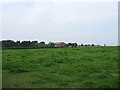
Lower Hoddern Farm
Built sometime in the late 1960s or early 1970s and located at the eastern edge of the northern part of Peacehaven.
Image: © Simon Carey
Taken: 2 Jun 2012
0.09 miles
3
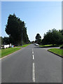
Pelham Rise
The road was constructed in the late 1970s to serve as an access route for the new estates and closes springing up as the northern part of Peacehaven from Firle Road to Telscombe Road had many of its vacant plots filled. The road heads east from Roderick Avenue before turning north towards Telscombe Road. This looks southwards past the junction with Glynn Road and the entrance to the business units next to Lower Hoddern Farm.
Image: © Simon Carey
Taken: 16 Jun 2012
0.12 miles
4
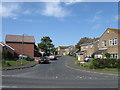
Coney Furlong
Small estate of Pelham Rise constructed in the early 1980s.
Image: © Simon Carey
Taken: 16 Jun 2012
0.12 miles
5
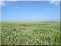
Gallows Hill (2)
The name of the field according to Piddinghoe's 1843 tithe map. The rise to the right may be the point alluded to in the title though in effect all this field is now on the western slope of Lodge Hill. The old field boundary itself once covered an area south to roughly Firle Road. See also Image and Image
Image: © Simon Carey
Taken: 16 Jun 2012
0.13 miles
6
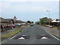
Cripps Avenue
One of the original roads of the town that ran north from Glynn Road to Telscombe Road. When the northern end of Peacehaven was developed a new access route, Pelham Rise, was built which subsequently took over the northern end of this road up to Telscombe Road.
Image: © Simon Carey
Taken: 2 Jun 2012
0.15 miles
7
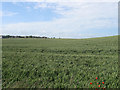
Gallows Hill (3)
The name of the field according to Piddinghoe's 1843 tithe map viewed from the drive to Hoddern Farm that is also a public footpath. The field itself falls within the boundaries of the new South Downs National Park which may well mean it remains undeveloped and the edge of Peacehaven in the distance stays where it is. See also Image and Image
Image: © Simon Carey
Taken: 16 Jun 2012
0.16 miles
8
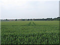
Gallows Hill (1)
The name of the field according to Piddinghoe's 1843 tithe map. This is the southern end south of Image, the northern end running south of Lodge Hill. The estates of northern Peacehaven can be seen at the opposite end of the field.
Image: © Simon Carey
Taken: 2 Jun 2012
0.17 miles
10
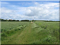
Bridleway to Lower Hoddern Farm
The original course of the bridleway linked Piddinghoe Avenue to the farm then turned west onto Glynn Road. The southern part has currently disappeared under the Image development necessitating a diversion eastwards to use Image See also Image The roof of the farm is just visible to the left.
Image: © Simon Carey
Taken: 9 Jun 2012
0.21 miles