IMAGES TAKEN NEAR TO
McWilliam Road, BOURNEMOUTH, BH9 3BA

Introduction

This page details the photographs taken nearby to McWilliam Road, BH9 3BA by members of the Geograph project.

The Geograph project started in 2005 with the aim of publishing, organising and preserving representative images for every square kilometre of Great Britain, Ireland and the Isle of Man.

There are currently over 7.5m images from over14,400 individuals and you can help contribute to the project by visiting https://www.geograph.org.uk

Image Map


Images are licensed for reuse under creativecommons.org/licenses/by-sa/2.0
Notes
  • Clicking on the map will re-center to the selected point.
  • The higher the marker number, the further away the image location is from the centre of the postcode.

Image Listing (82 Images Found)

Images are licensed for reuse under creativecommons.org/licenses/by-sa/2.0
  • ...
Image
Details
Distance
1
Moordown: McWilliam Road
A funny little backwater of a road, not at all typical of the area. It contains literally only six or seven premises, ranging from the relatively modern house on the left to the thatched cottage (quite possibly the only one in Moordown) at the end (see Image).
Image: © Chris Downer Taken: 22 Jun 2016
0.01 miles
2
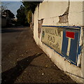
Moordown: McWilliam Road
A short road, more of a lane with no pavements either side and ending at an old thatched cottage, one of few very old buildings to survive among the more modern suburbia (see Image). The sign is one of the first to include the borough logo, by the look of it, dating from around 2000. This is photo no.241 of a series of 453 in my coronavirus lockdown walking project: See https://www.geograph.org.uk/article/My-2020-Coronavirus-Lockdown-walking-project for the complete set of photos.
Image: © Chris Downer Taken: 12 Apr 2020
0.02 miles
3
Moordown: footpath M11 from the dead end of McWilliam Road
We have reached Image and here at right-angles is a short public footpath to Mayfield Road. See Image for the view of its emergence. (The gateway to the left is to one of the oldest buildings in the area: Image).
Image: © Chris Downer Taken: 26 Feb 2017
0.03 miles
4
Moordown: the end of McWilliam Road
Image] comes to an abrupt end, at this gateway to what is, to my knowledge, the only thatched cottage in the whole Moordown area - see Image Just to the right is a short path, public footpath M11, to Mayfield Road. See Image] for a view along the footpath.
Image: © Chris Downer Taken: 22 Jun 2016
0.03 miles
5
Moordown: thatched cottage in McWilliam Road
Only a glimpse of this thatched cottage, at Image], is available from the gateway. It is, to my knowledge, the only thatched cottage in the Moordown area, a rural looking enclave in the midst of much late 19th and early 20th century development, and much more recent stuff too.
Image: © Chris Downer Taken: 22 Jun 2016
0.03 miles
6
Moordown: footpath M11 to McWilliam Road
Looking along this short path, leading to Image from Mayfield Road. This is an extension of the more substantial straight path (Image) behind us to Wimborne Road. See Image for the view towards us from a little way along the path.
Image: © Chris Downer Taken: 22 Jun 2016
0.03 miles
7
Moordown: footpath M11 comes out opposite footpath M01
Looking out of this short public footpath from McWilliam Road as it emerges onto Mayfield Road. Directly opposite is a much longer path, number M01, which continues the straight course to Wimborne Road. See: Image for a view towards us from the end of the path; Image for a view up this path from the end behind us; and Image for a view along footpath M01, ahead, with links to further photos on that route.
Image: © Chris Downer Taken: 26 Feb 2017
0.05 miles
8
Moordown: footpath M01 from Mayfield Road
A dead-straight public footpath, just over 200m in length, leads to the main Wimborne Road. See Image for the next view along the path. The straight course of the path is continued behind us by way of another path: Image
Image: © Chris Downer Taken: 22 Jun 2016
0.05 miles
9
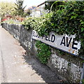
Moordown: Bloomfield Avenue
This suburban road of decent detached houses has a few bungalows at this end, as we can see, and runs between the main Wimborne Road and Mayfield Road. We look along it from the latter. The sign is a standard 1980s one, affixed to tubular steel that protrudes at each end. This is photo no.41 of a series of 453 in my coronavirus lockdown walking project: See https://www.geograph.org.uk/article/My-2020-Coronavirus-Lockdown-walking-project for the complete set of photos.
Image: © Chris Downer Taken: 10 Apr 2020
0.06 miles
10
Moordown: graffiti on footpath M01
Looking along this public footpath, between Wimborne and Mayfield Roads, towards the latter end. There is a fair bit of graffiti on the walls on the right. See Image for the next photo along the path behind us, and Image for a view towards us from the end ahead.
Image: © Chris Downer Taken: 22 Jun 2016
0.07 miles
  • ...