
IMAGES TAKEN NEAR TO
Cunningham Close, BOURNEMOUTH, BH11 8EB
Introduction
This page details the photographs taken nearby to Cunningham Close, BH11 8EB by members of the Geograph project.
The Geograph project started in 2005 with the aim of publishing, organising and preserving representative images for every square kilometre of Great Britain, Ireland and the Isle of Man.

There are currently over 7.5m images from over14,400 individuals and you can help contribute to the project by visiting https://www.geograph.org.uk
Image Map
Images are licensed for reuse under creativecommons.org/licenses/by-sa/2.0
Notes
- Clicking on the map will re-center to the selected point.
- The higher the marker number, the further away the image location is from the centre of the postcode.
Image Listing (77 Images Found)
Images are licensed for reuse under creativecommons.org/licenses/by-sa/2.0
Image
Details
Distance
1
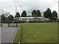
West Howe Primary Care Centre
Off Cunningham Crescent. http://www.nhs.uk/servicedirectories/pages/trust.aspx?id=5qn
Image: © Mike Faherty
Taken: 21 Feb 2010
0.02 miles
2
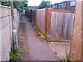
West Howe: footpath U31 is to the right
Looking along a path at the back of odd-numbered houses in Moore Avenue. Unlike this path, the one to our right is designated a public right of way, number U31. A short distance ahead of us, where the dark scar in the tarmac comes to an end, an opening in the wall leads to Cunningham Close. See Image for more discussion, and Image] for a view down the path from this top end.
Image: © Chris Downer
Taken: 27 Jun 2016
0.03 miles
3
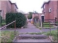
West Howe: footpath U31 to Cunningham Close (almost)
A man walks up this short public footpath that leads between houses in Moore Avenue to a path (not also designated a public footpath) running behind them. The end of Cunningham Close is just behind the wall at the back, but the path leads to it only indirectly (see Image).
See Image for a view down the path from the end, and Image for a view of the steps on which we are standing.
Image: © Chris Downer
Taken: 27 Jun 2016
0.04 miles
4
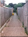
West Howe: footpath U31 to Moore Avenue
Looking down this short public footpath from its top end.
See Image] for an upward view and more discussion; and Image for a view along the path just behind us, onto which this one leads.
Image: © Chris Downer
Taken: 27 Jun 2016
0.04 miles
5
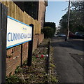
West Howe: Cunningham Close
A side road off Cunningham Place, in the middle of the vast 1950s West Howe council estate. The houses cannot really be seen from the end of the road, because they are arranged in a wide circle around the dead end of the road - just behind the back gardens of the houses either side.
The sign dates from 2010-15 when this more modern, abstract emblem rather than the traditional town coat of arms as the working logo of the council.
This is photo no.97 of a series of 453 in my coronavirus lockdown walking project:
See https://www.geograph.org.uk/article/My-2020-Coronavirus-Lockdown-walking-project for the complete set of photos.
Image: © Chris Downer
Taken: 11 Apr 2020
0.04 miles
6
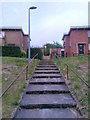
West Howe: steps to Moore Avenue houses and footpath U31
The houses on the eastern side of this segment of Moore Avenue are up a grass bank from the main carriageway. These steps therefore provide access to them - a ramped path is available nearby too.
The steps are directly in line with a public footpath heading between these two houses - see Image] for more discussion and further links.
Image: © Chris Downer
Taken: 27 Jun 2016
0.05 miles
7
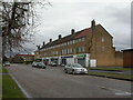
West Howe, shopping parade
On the northern side of Cunningham Crescent; from the right, Chinese take-away, convenience store, café, post office, pharmacy, community network.
Image: © Mike Faherty
Taken: 21 Feb 2010
0.05 miles
8
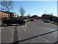
Bournemouth : Cunningham Place
Cunningham Place on the road junction with Cunningham Crescent.
Image: © Lewis Clarke
Taken: 8 Mar 2010
0.05 miles
9
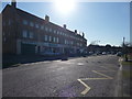
Bournemouth : Cunningham Crescent
Some shops on the road include a convenience store, and a post office.
Image: © Lewis Clarke
Taken: 8 Mar 2010
0.05 miles
10
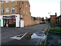
West Howe: footpath U43 from Cunningham Crescent shops
This end of the public footpath coincides with the driveway to the rear of Image It continues as a more typical footpath (below the lamp of the lamppost) to the southern arm of Cunningham Crescent: Image
Image: © Chris Downer
Taken: 28 Jun 2016
0.06 miles