IMAGES TAKEN NEAR TO
TURRIFF, AB53 5RJ

Introduction

This page details the photographs taken nearby to AB53 5RJ by members of the Geograph project.

The Geograph project started in 2005 with the aim of publishing, organising and preserving representative images for every square kilometre of Great Britain, Ireland and the Isle of Man.

There are currently over 7.5m images from over14,400 individuals and you can help contribute to the project by visiting https://www.geograph.org.uk

Image Map


Images are licensed for reuse under creativecommons.org/licenses/by-sa/2.0
Notes
  • Clicking on the map will re-center to the selected point.
  • The higher the marker number, the further away the image location is from the centre of the postcode.

Image Listing (11 Images Found)

Images are licensed for reuse under creativecommons.org/licenses/by-sa/2.0
Image
Details
Distance
1
Sheep at Plaidy
The field is next to the A947 road from Turriff to Banff, which cuts across the corner of the grid square.
Image: © David Hawgood Taken: 13 Sep 2007
0.02 miles
2
Railway Bridge at Plaidy
Even though the map told me that Image] was the railway route, I wasn't totally convinced until I saw the bridge. There's no mistaking that!
Image: © Anne Burgess Taken: 1 May 2013
0.03 miles
3
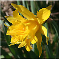
Wild Daffodil?
This looks very like what I was once told is a wild daffodil, from which all the thousands of modern varieties have been cultivated.
Image: © Anne Burgess Taken: 1 May 2013
0.05 miles
4
Wild Daffodil?
This looks very like what I was once told is a wild daffodil, from which all the thousands of modern varieties have been cultivated.
Image: © Anne Burgess Taken: 1 May 2013
0.05 miles
5
Lower Plaidy
This traditional red sandstone house stands right beside the A947.
Image: © Anne Burgess Taken: 1 May 2013
0.05 miles
6
Former Railway Line
This, believe it or not, is the trackbed of the Great North of Scotland Railway to Macduff. It must be, because the map says so; I would never have recognised it as such without the map to tell me. However, see Image
Image: © Anne Burgess Taken: 1 May 2013
0.05 miles
7
Plaidy railway station (site), Aberdeenshire
Opened in 1860 by the Banff Macduff & Turriff Extension Railway, later part of the Great North of Scotland Railway, on the line from Inveramsay to Macduff, this station closed to passengers in 1944 and completely in 1961. View south towards the station site (hidden in the trees), Turriff and Inveramsay.
Image: © Nigel Thompson Taken: 6 Sep 2019
0.05 miles
8
Cottages, Lower Plaidy
Image: © JThomas Taken: 14 Sep 2010
0.07 miles
9
Property for sale at Craig.
Image: © Des Colhoun Taken: 13 Sep 2006
0.18 miles
10
North Plaidy
Bizarrely, North Plaidy seems to be south of both Plaidy and Lower Plaidy, though the mid-Victorian six-inch map just names this Plaidy. Back Plaidy and Bogs of Plaidy are further south again.
Image: © Anne Burgess Taken: 1 May 2013
0.23 miles