IMAGES TAKEN NEAR TO
Salisbury Terrace, TEIGNMOUTH, TQ14 8JA
Introduction
This page details the photographs taken nearby to Salisbury Terrace, TQ14 8JA by members of the Geograph project.
The Geograph project started in 2005 with the aim of publishing, organising and preserving representative images for every square kilometre of Great Britain, Ireland and the Isle of Man.

There are currently over 7.5m images from over14,400 individuals and you can help contribute to the project by visiting https://www.geograph.org.uk
Image Map
Images are licensed for reuse under creativecommons.org/licenses/by-sa/2.0
Notes
- Clicking on the map will re-center to the selected point.
- The higher the marker number, the further away the image location is from the centre of the postcode.
Image Listing (1277 Images Found)
Images are licensed for reuse under creativecommons.org/licenses/by-sa/2.0
Image
Details
Distance
1
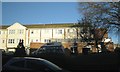
Beechcroft and the Teignmouth Day Centre, Salisbury Terrace
A facility of Devon Community Services.
Image: © Robin Stott
Taken: 10 Dec 2012
0.01 miles
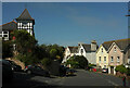
2
Shute Hill meets Higher Brimley
Heywood Road drops down, centre. The site of Image is just beyond the white van.
Image: © Robin Stott
Taken: 6 May 2012
0.03 miles
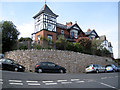
3
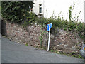
Steep corner, top of Heywoods Road
At the confluence of Higher Brimley, Heywoods Road and Shute Hill, a wall of Teignmouth breccia with a grey limestone coping. The top end of the wall appears on the left in Image
Image: © Robin Stott
Taken: 6 May 2012
0.03 miles
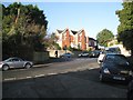
5
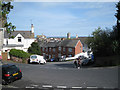
Junction, Teignmouth
Higher Brimley Road curves left past Winterbourne Road (left) and Shute Hill (right). In addition, Heywoods Road Image] turns off the latter a few metres out of shot.
Image: © Derek Harper
Taken: 30 May 2021
0.03 miles
6
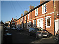
Retaining wall, corner of Higher Brimley
A serious, modern retaining wall. Without retaining walls the town would slide into the Teign. Seen from the top of Shute Hill.
Image: © Robin Stott
Taken: 6 May 2012
0.03 miles
7
Junction of Shute Hill and Higher Brimley
The view is from the top of Heywoods Road http://www.geograph.org.uk/photo/3196513 Heywoods Road is steep http://www.geograph.org.uk/photo/3196420
Image: © Robin Stott
Taken: 10 Dec 2012
0.03 miles
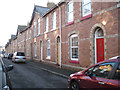
9
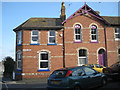
East end of Salisbury Terrace
Polychrome brickwork and strong paint colours make an eye-catching building. The part on the left is the dental surgery seen in Image
Image: © Robin Stott
Taken: 6 May 2012
0.04 miles
10
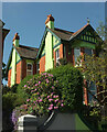
House, Higher Brimley Road, Teignmouth
A bold colour choice for one of the semis shown in Image
Image: © Derek Harper
Taken: 30 May 2021
0.04 miles