IMAGES TAKEN NEAR TO
Simkins Close, LONDON, SW2 5BU
Introduction
This page details the photographs taken nearby to Simkins Close, SW2 5BU by members of the Geograph project.
The Geograph project started in 2005 with the aim of publishing, organising and preserving representative images for every square kilometre of Great Britain, Ireland and the Isle of Man.

There are currently over 7.5m images from over14,400 individuals and you can help contribute to the project by visiting https://www.geograph.org.uk
Image Map
Images are licensed for reuse under creativecommons.org/licenses/by-sa/2.0
Notes
- Clicking on the map will re-center to the selected point.
- The higher the marker number, the further away the image location is from the centre of the postcode.
Image Listing (36 Images Found)
Images are licensed for reuse under creativecommons.org/licenses/by-sa/2.0
Image
Details
Distance
1
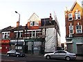
The Duke of Wellington, Public House, Brixton
Closed public house on the A2217 Acre Lane.
Image: © David Anstiss
Taken: 2 Oct 2011
0.04 miles
2
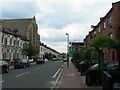
Solon Road SW2
Brixton Baptist Church pops up rather incongruously out of the middle of these terrace houses on a quiet residential side street.
Image: © Danny P Robinson
Taken: 15 Aug 2006
0.06 miles
3
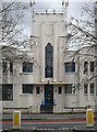
Detail of 125 Acre Lane
A close-up of the centrepiece of this 1930s factory. See here for a full view: Image
Image: © Stephen Richards
Taken: Unknown
0.06 miles
4
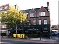
The Grand Union, Public House, Brixton
On the A2217 Acre Lane.
Image: © David Anstiss
Taken: 2 Oct 2011
0.06 miles
5
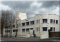
125 Acre Lane
A good 1930s factory, occupied by various laundering companies for many years. See here for a close-up of the centrepiece: Image
Image: © Stephen Richards
Taken: Unknown
0.06 miles
6
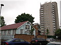
The Bible Truth of God Church, Clapham
On Hetherington Road.
In the background a towerblock of housing on Solon New Road.
Image: © David Anstiss
Taken: 3 Jun 2012
0.07 miles
7

Disused buildings, Acre Lane
At the junction with Kings Avenue. C20th brick offices and what looks like a factory or some sort of warehouse behind. There is an estate agent's sign but they've been empty for several years.
Update: this was demolished around April/May 2011 and turned into a very large pile of bricks, which still fills the site at December 2011.
Further update: still no building by October 2012, the site still partially occupied by the aforementioned bricks, together with an unmade-up car park and open-air car showroom.
Image: © Stephen Richards
Taken: Unknown
0.08 miles
8
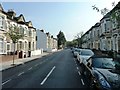
Corrance Road, Brixton
Looking south towards Acre Lane. Raeburn Street visible on left.
Image: © Clint Mann
Taken: 16 Sep 2014
0.10 miles
9
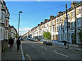
Sandmere Road, SW4
Near the corner of Tintern Street. Parking is for residents only -- if it was unrestricted the road would be jammed with parked commuters cars.
Image: © Danny P Robinson
Taken: 21 Nov 2007
0.10 miles