Disused buildings, Acre Lane
Introduction
The photograph on this page of Disused buildings, Acre Lane by Stephen Richards as part of the Geograph project.
The Geograph project started in 2005 with the aim of publishing, organising and preserving representative images for every square kilometre of Great Britain, Ireland and the Isle of Man.

There are currently over 7.5m images from over 14,400 individuals and you can help contribute to the project by visiting https://www.geograph.org.uk
Disused buildings, Acre Lane
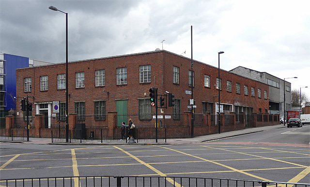
Image: © Stephen Richards Taken: Unknown
At the junction with Kings Avenue. C20th brick offices and what looks like a factory or some sort of warehouse behind. There is an estate agent's sign but they've been empty for several years. Update: this was demolished around April/May 2011 and turned into a very large pile of bricks, which still fills the site at December 2011. Further update: still no building by October 2012, the site still partially occupied by the aforementioned bricks, together with an unmade-up car park and open-air car showroom.
Images are licensed for reuse under creativecommons.org/licenses/by-sa/2.0
Image Location
Latitude
51.459657
Longitude
-0.128297