
IMAGES TAKEN NEAR TO
Merrivale Grove, SWINDON, SN3 1EH
Introduction
This page details the photographs taken nearby to Merrivale Grove, SN3 1EH by members of the Geograph project.
The Geograph project started in 2005 with the aim of publishing, organising and preserving representative images for every square kilometre of Great Britain, Ireland and the Isle of Man.

There are currently over 7.5m images from over14,400 individuals and you can help contribute to the project by visiting https://www.geograph.org.uk
Image Map
Images are licensed for reuse under creativecommons.org/licenses/by-sa/2.0
Notes
- Clicking on the map will re-center to the selected point.
- The higher the marker number, the further away the image location is from the centre of the postcode.
Image Listing (51 Images Found)
Images are licensed for reuse under creativecommons.org/licenses/by-sa/2.0
Image
Details
Distance
1
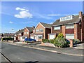
Merrivale Grove
c.1970s? housing in a cul-de-sac off Thurlestone Road.
Image: © Ian Capper
Taken: 14 Jul 2022
0.01 miles
2
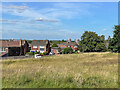
The Lawn
Public park formed from the former estate of the Goddard family. The houses are in Merrivale Grove. The blocks of flats in the background are Milverton Court and Torrington Court in Banwell Avenue, both completed in 1964.
Image: © Ian Capper
Taken: 14 Jul 2022
0.02 miles
3
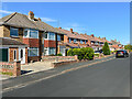
Thurlestone Road
c.1960s? housing in Upham Road in the Walcot West suburb of Swindon.
Image: © Ian Capper
Taken: 14 Jul 2022
0.06 miles
4
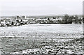
A wintry view from The Lawn park
This view is across part of The Lawn public park. In the distance on the left is Old or West Walcot. The tower blocks in the far distance are on the Park North housing estate. Image
Image: © P L Chadwick
Taken: Unknown
0.08 miles
5
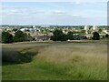
View from the edge of The Lawn
Looking across to the late 20th century developments of Walcot West and Park North.
Image: © Alan Murray-Rust
Taken: 14 Jul 2022
0.10 miles
6
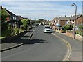
Parklands Road
Part of the mid/late 20th century Walcot West development.
Image: © Alan Murray-Rust
Taken: 14 Jul 2022
0.11 miles
7
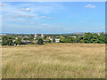
The Lawn
Public park formed from the former estate of the Goddard family. In the background is Churchfields Academy. The blocks of flats beyond are Milverton Court and Torrington Court in Banwell Avenue, both completed in 1964.
Image: © Ian Capper
Taken: 14 Jul 2022
0.12 miles
8
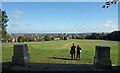
View from The Lawn
The Lawn is a large hillside park surrounded by suburban Swindon but still feeling like you're out of town.
Once the estate of a long gone country house, these two pillars are a remnant from those days.
The Downs are on the horizon.
Image: © Des Blenkinsopp
Taken: 10 Oct 2022
0.12 miles
9
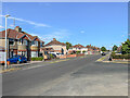
Upham Road
c.1930s housing in Upham Road in the Walcot West suburb of Swindon.
Image: © Ian Capper
Taken: 14 Jul 2022
0.13 miles
10
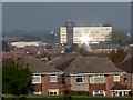
Falmouth Grove, Swindon
Falmouth Grove is part of the Walcot West area of private housing developed in the years before and after the second world war. The houses visible here would have been built in the 1960s. Beyond is the UK headquarters of the well-known retailer, W H Smith in SU1785 over two kilometres away to the north-east and the subject of this image Image
Image: © Brian Robert Marshall
Taken: 23 Oct 2007
0.13 miles