IMAGES TAKEN NEAR TO
Heol Cerwyn, FISHGUARD, SA65 9JE

Introduction

This page details the photographs taken nearby to Heol Cerwyn, SA65 9JE by members of the Geograph project.

The Geograph project started in 2005 with the aim of publishing, organising and preserving representative images for every square kilometre of Great Britain, Ireland and the Isle of Man.

There are currently over 7.5m images from over14,400 individuals and you can help contribute to the project by visiting https://www.geograph.org.uk

Image Map


Images are licensed for reuse under creativecommons.org/licenses/by-sa/2.0
Notes
  • Clicking on the map will re-center to the selected point.
  • The higher the marker number, the further away the image location is from the centre of the postcode.

Image Listing (305 Images Found)

Images are licensed for reuse under creativecommons.org/licenses/by-sa/2.0
  • ...
Image
Details
Distance
1
Morfa Las, Fishguard
Image: © Colin Pyle Taken: 7 Jun 2023
0.07 miles
2
Recycling for the Sally Ann
Donated clothing receptacles being swopped, empty for full, in the carpark.
Image: © Natasha Ceridwen de Chroustchoff Taken: 22 Dec 2009
0.10 miles
3
Garn Fawr with view of the bay
The sea view opens up towards the top of the road.
Image: © Natasha Ceridwen de Chroustchoff Taken: 18 Jan 2009
0.11 miles
4
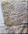
Ordnance Survey Cut Mark
This OS cut mark can be found on the garage at Prospect House. It marks a point 81.226m above mean sea level.
Image: © Adrian Dust Taken: 4 Mar 2020
0.11 miles
5
Morfa Las
Post-war housing estate behind Hermon Baptist chapel.
Image: © Natasha Ceridwen de Chroustchoff Taken: 18 Jan 2009
0.11 miles
6
Garn Fawr
Post-war housing estate behind Hermon Baptist chapel.
Image: © Natasha Ceridwen de Chroustchoff Taken: 18 Jan 2009
0.12 miles
7
Morfa Las estate
Post-war housing estate behind Hermon Baptist chapel.
Image: © Natasha Ceridwen de Chroustchoff Taken: 18 Jan 2009
0.12 miles
8
Pen Wallis, looking north to Fishguard Bay
This is the highest point of the town, on the southern edge, looking down Wallis Street and out towards the harbour at Goodwick. Much of the housing in this area dates from the latter part of the C20.
Image: © Natasha Ceridwen de Chroustchoff Taken: 22 Aug 2007
0.13 miles
9
Hermon Baptist Chapel
An impressive chapel in the High Street with a strikingly original facade, built in 1832 (the other date 1776 presumably represents an earlier foundation). The subtle dark and light green colour scheme enhances the classical simplicity of the architecture.
Image: © Natasha Ceridwen de Chroustchoff Taken: 5 Dec 2006
0.13 miles
10
Hermon graveyard
The old graveyard lies to the right of the chapel, with burials dating back to early C19. The backs of some of the High Street houses can be seen beyond.
Image: © Natasha Ceridwen de Chroustchoff Taken: 6 Nov 2008
0.13 miles
  • ...