
IMAGES TAKEN NEAR TO
Wivelsfield Road, HAYWARDS HEATH, RH16 4EP
Introduction
This page details the photographs taken nearby to Wivelsfield Road, RH16 4EP by members of the Geograph project.
The Geograph project started in 2005 with the aim of publishing, organising and preserving representative images for every square kilometre of Great Britain, Ireland and the Isle of Man.

There are currently over 7.5m images from over14,400 individuals and you can help contribute to the project by visiting https://www.geograph.org.uk
Image Map
Images are licensed for reuse under creativecommons.org/licenses/by-sa/2.0
Notes
- Clicking on the map will re-center to the selected point.
- The higher the marker number, the further away the image location is from the centre of the postcode.
Image Listing (58 Images Found)
Images are licensed for reuse under creativecommons.org/licenses/by-sa/2.0
Image
Details
Distance
1
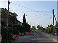
Roadworks, Wivelsfield Road
A three way temporary traffic light has been installed on the B2112 for the duration of the construction of Image The cottages on the left were built in 1863 in anticipation of the workforce needed at the recently constructed Sussex County Asylum.
The road once formed the boundary between Wivelsfield parish on the left and Keymer parish to the right with both areas transferred to Haywards Heath in 1934.
Image: © Simon Carey
Taken: 30 Apr 2011
0.01 miles
2
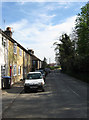
Colwell Road
See Image for a history. The cottages on the left were built during the 1860s with locally quarried sandstone. This part of the road is being turned into a cul-de-sac due to the construction of the Haywards Heath relief road.
This area of Haywards Heath was once part of Wivelsfield parish until boundary changes in 1934.
Image: © Simon Carey
Taken: 10 Apr 2011
0.02 miles
3
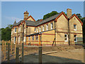
Larchwood House
Originally built as the superintendent's residence and was later converted into a private hospital for children. The building has stood vacant for a while but is now being converted into residences.
Image: © Simon Carey
Taken: 30 Apr 2011
0.05 miles
4
Kennards Lane into housing estate, Southdown Park
Image: © David Smith
Taken: 5 Sep 2024
0.05 miles
5
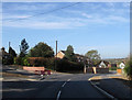
New Entrance, Colwell Road
There has always been an access road here but it has now been widened as the old entrance to Colwell Road will be blocked up due to the construction of a roundabout for the forthcoming Haywards Heath relief road. See Image
This area of Haywards Heath was once part of the parish of Wivelsfield until borders were redrawn in 1934.
Image: © Simon Carey
Taken: 10 Apr 2011
0.06 miles
6
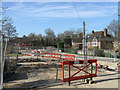
Old Entrance, Colwell Road
Formerly a crossroads with Rocky Lane and Wivelsfield Road, the B2112. A Image is being constructed for the forthcoming Haywards Heath relief road which will follow the course of Rocky Lane opposite then head down a new route to the left.
This area of Haywards Heath was until 1934 part of the parish of Wivelsfield.
Image: © Simon Carey
Taken: 10 Apr 2011
0.07 miles
7
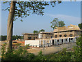
St Francis Park
New housing estate being built as part of the Haywards Heath relief road scheme. It lies between the western edge of Southdowns Park, the former St Francis Hospital and the remains of Anscombe Wood in the distance to the left much of which has been grubbed to make way for the estate. A small field called Nine Acres, according to Wivelsfield's 1843 tithe map once stood to the immediate right.
The area was part of Wivelsfield parish until 1934 when it was transferred to Haywards Heath
Image: © Simon Carey
Taken: 30 Apr 2011
0.07 miles
8
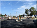
New Roundabout, Haywards Heath Relief Road (2)
Image: © Simon Carey
Taken: 10 Apr 2011
0.07 miles
9
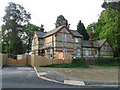
Lodge, Colwell Road
Built in 1860 at the service gate to what was originally the Sussex County Lunatic Asylum and later St Francis Hospital until its closure in 1995. Now a private home.
This area was originally part of Wivelsfield parish until transferred to Haywards Heath in 1934.
Image: © Simon Carey
Taken: 30 Apr 2011
0.07 miles
10
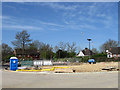
New Roundabout, Haywards Heath Relief Road (1)
Replacing the former junction with the B2112 and two minor routes, Rocky Lane and Colwell Road. The rerouted A272 will cross the roundabout east-west, see Image A small open area that previously existed in front of the house on the left was once the location of a toll booth for users of the former turnpike.
This area of Haywards Heath was until 1934 part of the parish of Wivelsfield.
Image: © Simon Carey
Taken: 10 Apr 2011
0.08 miles