
IMAGES TAKEN NEAR TO
Cuckfield Road, BURGESS HILL, RH15 8RG
Introduction
This page details the photographs taken nearby to Cuckfield Road, RH15 8RG by members of the Geograph project.
The Geograph project started in 2005 with the aim of publishing, organising and preserving representative images for every square kilometre of Great Britain, Ireland and the Isle of Man.

There are currently over 7.5m images from over14,400 individuals and you can help contribute to the project by visiting https://www.geograph.org.uk
Image Map
Images are licensed for reuse under creativecommons.org/licenses/by-sa/2.0
Notes
- Clicking on the map will re-center to the selected point.
- The higher the marker number, the further away the image location is from the centre of the postcode.
Image Listing (16 Images Found)
Images are licensed for reuse under creativecommons.org/licenses/by-sa/2.0
Image
Details
Distance
1
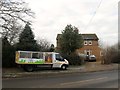
Paynes Place Cottages, Cuckfield Road
Built in the mid 19th century at the entrance to Paynes Place Farm. Marked on OS maps up the 1950s as Pain's Cottages acquiring their current name by the 1977 edition.
Image: © Simon Carey
Taken: 30 Dec 2014
0.00 miles
2
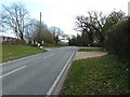
The B2036, Cuckfield Road
On the left is the entrance to Lye's Farm and to the right is Paynes Place Farm.
Image: © Dave Spicer
Taken: 6 Mar 2011
0.01 miles
3
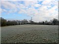
Kiln Field
The name of the field according to Cuckfield's 1843 tithe map that has been merged with Image and Image to the west to form a larger unit. It is bounded by Image to the north and Image to the south whilst Image is at the eastern end on the B2036.
Image: © Simon Carey
Taken: 30 Dec 2014
0.04 miles
4
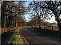
Pain's Flat
The name of the section of the B2036 between the entrance to Moonhill Place which is located immediately behind me and the entrance to Lye's Farm which is located to the south on a small ridge.
Image: © Simon Carey
Taken: 13 Dec 2014
0.07 miles
5
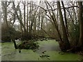
Kilnfield Pit
A small wood next to the B2036 containing a couple of ponds with the one in view being the smaller of the two. The name appears on Cuckfield's 1843 tithe map and is still marked as such on maps today.
Image: © Simon Carey
Taken: 30 Dec 2014
0.07 miles
6
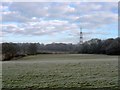
The Banks/Kiln Field Plot
The name of the fields according to Cuckfield's 1843 tithe map that have been merged together along with Image to the west and Image to the east to form a larger unit. The Banks was in the foreground on the slope whilst Kiln Field plot is squeezed between Image to the west and Image to the east. To the north is Image
Image: © Simon Carey
Taken: 30 Dec 2014
0.14 miles
7
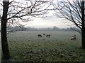
Upper Nine Acres/Seven Acres
The name of the fields according to Cuckfield's 1843 tithe map that have been merged to form a larger unit with Upper Nine Acres on the eastern side adjacent to Cuckfield Road, the B2036, and Seven Acres occupying the western portion. To the north is Image
Image: © Simon Carey
Taken: 30 Dec 2014
0.15 miles
8
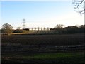
Old Denshire Field/Lower Kiln Field/Upper Kiln Field
The name of the fields according to Cuckfield's 1843 tithe map. Old Denshire Field is in the foreground whilst beyond the hedge at the far end is Lower Kiln Field on the flat and Upper Kiln Field on the slope.
Image: © Simon Carey
Taken: 13 Dec 2014
0.16 miles
9

Pylon by Pain's Flat
Another view of the pylon is at Image
Image: © Shazz
Taken: 14 Jul 2014
0.16 miles
10
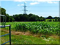
Field with pylon by Pains Flat
A view of the pylon from the road is at
Image
Image: © Shazz
Taken: 14 Jul 2014
0.16 miles