
IMAGES TAKEN NEAR TO
Moss Drive, NOTTINGHAM, NG9 3NF
Introduction
This page details the photographs taken nearby to Moss Drive, NG9 3NF by members of the Geograph project.
The Geograph project started in 2005 with the aim of publishing, organising and preserving representative images for every square kilometre of Great Britain, Ireland and the Isle of Man.

There are currently over 7.5m images from over14,400 individuals and you can help contribute to the project by visiting https://www.geograph.org.uk
Image Map
Images are licensed for reuse under creativecommons.org/licenses/by-sa/2.0
Notes
- Clicking on the map will re-center to the selected point.
- The higher the marker number, the further away the image location is from the centre of the postcode.
Image Listing (104 Images Found)
Images are licensed for reuse under creativecommons.org/licenses/by-sa/2.0
Image
Details
Distance
1
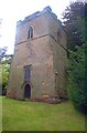
The Sunken Church, Bramcote
A small church existed in Bramcote as early as 1246 and it has been suggested that this tower could have been part of that church. Whatever the truth, the tower standing in the graveyard is all that now remains of St Luke's and is known locally as the "Sunken Church".
Image: © Garth Newton
Taken: 23 Aug 2003
0.03 miles
2
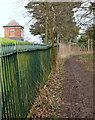
Bramcote NG9, Notts.
Some walkers enter the middle portion of the village via this footpath, having climbed uphill across a couple of fields overlooking the Burnt Hill area. Having come through a unusually high kissing gate (6'3" tall), ramblers and dog-walkers follow this path that runs parallel with the boundary fence of a Severn-Trent Water Authority covered reservoir. Round the right-hand bend the footpath passes the reservoir entrance gates and then joins Moss Drive, a short cul-de-sac that joins Town Street (the 'main' road through the village).
Image: © David Hallam-Jones
Taken: 21 Mar 2013
0.03 miles
3
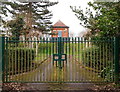
Bramcote NG9, Notts.
The entrance gates into a Severn-Trent Water Authority site known as the "Bramcote covered reservoir and secondary pumping station". It is situated along a track off Moss Drive to the right of this picture. Moss Drive is an extremely short cul-de-sac that links to/from Town Street (the 'main' road through the village). To the left of these gates ramblers can continue along a footpath through a unusually high kissing gate (6'3" tall) and onwards towards Burnt Hill and Stapleford.
Image: © David Hallam-Jones
Taken: 21 Mar 2013
0.04 miles
4
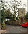
Bramcote NG9, Notts.
The tower of the 14th century former parish church seen from Moss Drive, a cul-de-sac that terminates behind the post van.
Image: © David Hallam-Jones
Taken: 21 Mar 2013
0.05 miles
5
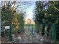
Bramcote Reservoir
Operated by Severn Trent Water.
Image: © Andrew Abbott
Taken: 7 Apr 2020
0.05 miles
6
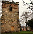
Bramcote NG9, Notts.
"The Sunken Tower" and a graveyard is all that remains of the former 14th century parish church on this elevated plot of land that overlooks a crossroads formed by Town Street, Moss Drive and Cow Lane. The four Longden almshouses (1852) on Cow Lane are visible to the right. The reference to the church being sunken relates to a belief that the rest of the church had sunk leaving only the tower standing. In fact the rest of the church was demolished, it being in a poor state of repair, shortly after Bramcote's new church, St Michael and All Angels, was built in the 1860's.
Image: © David Hallam-Jones
Taken: 21 Mar 2013
0.05 miles
7
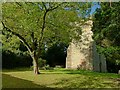
The Old Tower, Bramcote
This is all that remains of the medieval church, which was considerably decayed by the middle of the 19th century, and was replaced by the present church on Town Street in 1861.
Slated for complete demolition, in the end the 14th century tower was reprieved to provide a location for 'monuments and memorial plaques'. It still retains a late 16th century bell frame, although the bells were re-cast and transferred to the new church. The tower is Listed Grade II and with the surrounding garden is now looked after by the 'Friends of Bramcote Old church Tower'.
Image: © Alan Murray-Rust
Taken: 17 Oct 2016
0.05 miles
8
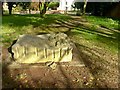
?Nature?, Bramcote Old Tower
One of a series of sculpted seats in the gardens surrounding the old church tower, created in Ancaster stone by local sculptor Andrew Smith working with the local community. Each has a granite panel with text by local writer Pat Ashworth.
For 'Nature', various items of local fauna and flora are illustrated. The accompanying text reads:
"Sing of scented yellow broom,
of lichened walls and mossy tomb,
of bluebell hill and sandy lanes,
of crocus field and daisy chains.
Of wind-borne seeds and herbs that heal,
of belfry bats and birds that wheel,
of strong-limbed yews that lend their shade
to ancient habitats remade.
A wilderness that time forgot
is transformed to a softer spot.
Now visitors can sit and greet
and children play upon this seat."
Image: © Alan Murray-Rust
Taken: 17 Oct 2016
0.05 miles
9
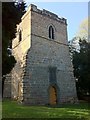
Bramcote Sunken Tower
Formerly part of the parish church of St Michael, Bramcote.
Image: © Andrew Abbott
Taken: 16 Oct 2011
0.05 miles
10
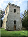
Tower of onetime church of St. Michael, Bramcote
The body of the church was demolished in the 1860s https://historicengland.org.uk/listing/the-list/list-entry/1248207?section=official-list-entry
Image: © Jonathan Thacker
Taken: 13 Apr 2022
0.05 miles