Bramcote NG9, Notts.
Introduction
The photograph on this page of Bramcote NG9, Notts. by David Hallam-Jones as part of the Geograph project.
The Geograph project started in 2005 with the aim of publishing, organising and preserving representative images for every square kilometre of Great Britain, Ireland and the Isle of Man.

There are currently over 7.5m images from over 14,400 individuals and you can help contribute to the project by visiting https://www.geograph.org.uk
Bramcote NG9, Notts.
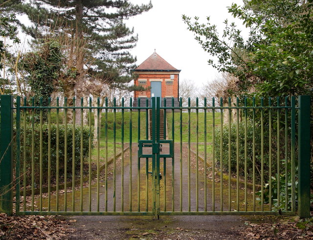
Image: © David Hallam-Jones Taken: 21 Mar 2013
The entrance gates into a Severn-Trent Water Authority site known as the "Bramcote covered reservoir and secondary pumping station". It is situated along a track off Moss Drive to the right of this picture. Moss Drive is an extremely short cul-de-sac that links to/from Town Street (the 'main' road through the village). To the left of these gates ramblers can continue along a footpath through a unusually high kissing gate (6'3" tall) and onwards towards Burnt Hill and Stapleford.
Images are licensed for reuse under creativecommons.org/licenses/by-sa/2.0
Image Location
Latitude
52.93224
Longitude
-1.24613