Bramcote NG9, Notts.
Introduction
The photograph on this page of Bramcote NG9, Notts. by David Hallam-Jones as part of the Geograph project.
The Geograph project started in 2005 with the aim of publishing, organising and preserving representative images for every square kilometre of Great Britain, Ireland and the Isle of Man.

There are currently over 7.5m images from over 14,400 individuals and you can help contribute to the project by visiting https://www.geograph.org.uk
Bramcote NG9, Notts.
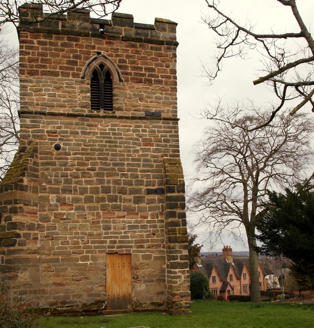
Image: © David Hallam-Jones Taken: 21 Mar 2013
"The Sunken Tower" and a graveyard is all that remains of the former 14th century parish church on this elevated plot of land that overlooks a crossroads formed by Town Street, Moss Drive and Cow Lane. The four Longden almshouses (1852) on Cow Lane are visible to the right. The reference to the church being sunken relates to a belief that the rest of the church had sunk leaving only the tower standing. In fact the rest of the church was demolished, it being in a poor state of repair, shortly after Bramcote's new church, St Michael and All Angels, was built in the 1860's.
Images are licensed for reuse under creativecommons.org/licenses/by-sa/2.0
Image Location
Latitude
52.932235
Longitude
-1.245237