The Sunken Church, Bramcote
Introduction
The photograph on this page of The Sunken Church, Bramcote by Garth Newton as part of the Geograph project.
The Geograph project started in 2005 with the aim of publishing, organising and preserving representative images for every square kilometre of Great Britain, Ireland and the Isle of Man.

There are currently over 7.5m images from over 14,400 individuals and you can help contribute to the project by visiting https://www.geograph.org.uk
The Sunken Church, Bramcote
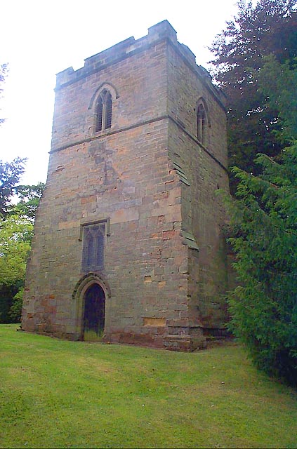
Image: © Garth Newton Taken: 23 Aug 2003
A small church existed in Bramcote as early as 1246 and it has been suggested that this tower could have been part of that church. Whatever the truth, the tower standing in the graveyard is all that now remains of St Luke's and is known locally as the "Sunken Church".
Images are licensed for reuse under creativecommons.org/licenses/by-sa/2.0
Image Location
Latitude
52.931967
Longitude
-1.245539