IMAGES TAKEN NEAR TO
Chapmans Meadows, ASHBY-DE-LA-ZOUCH, LE65 1JE
Introduction
This page details the photographs taken nearby to Chapmans Meadows, LE65 1JE by members of the Geograph project.
The Geograph project started in 2005 with the aim of publishing, organising and preserving representative images for every square kilometre of Great Britain, Ireland and the Isle of Man.

There are currently over 7.5m images from over14,400 individuals and you can help contribute to the project by visiting https://www.geograph.org.uk
Image Map
Images are licensed for reuse under creativecommons.org/licenses/by-sa/2.0
Notes
- Clicking on the map will re-center to the selected point.
- The higher the marker number, the further away the image location is from the centre of the postcode.
Image Listing (13 Images Found)
Images are licensed for reuse under creativecommons.org/licenses/by-sa/2.0
Image
Details
Distance
1
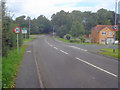
Entering Ashby
Heading north along Upper Packington Road. On the right is Chapmans Meadows and on the left beyond the town sign is Lower Packington Road. Although formally 'Ashby de la Zouch', the locals call it just plain 'Ashby'.
Image: © Trevor Rickard
Taken: 29 Aug 2009
0.06 miles
2
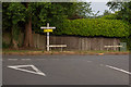
Junction between Upper and Lower Packington Road, Ashby
Viewed from Lower Packington Road, which continues right on the primary road. Upper Packington Road begins from this junction, and connects to Leicester Road further North.
Image: © Oliver Mills
Taken: 8 Jun 2020
0.06 miles
3
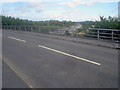
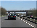
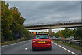
A42 bridge
Taking the Ashby Road over the dual carriageway.
Image: © Trevor Rickard
Taken: 29 Aug 2009
0.07 miles
7
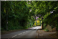
Upper Packington Road, Ashby-de-la-Zouch
Looking northwards, up a brief hill. The road crosses over the Leicester to Burton Railway, and eventually connects to Leicester Road.
Image: © Oliver Mills
Taken: 8 Jun 2020
0.11 miles
8
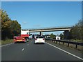
Ashby Road bridge over A42
The woods on each side hide the cul-de-sacs which are reminders of the former route of this road. The bridge is about 50 metres north-east of the former route.
Image: © David Smith
Taken: 16 Oct 2012
0.12 miles
9
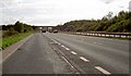
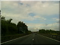
North West Leicestershire : The A42
The A42 dual carriageway between Junction 12 and Junction 13.
Image: © Lewis Clarke
Taken: 30 Sep 2018
0.17 miles
10
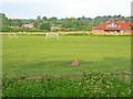
David Hunt Soccer School
Packington Road, Ashby-de-la-Zouch.
Image: © Oliver Dixon
Taken: 4 Jun 2006
0.18 miles