IMAGES TAKEN NEAR TO
Wrekin Close, ASHBY-DE-LA-ZOUCH, LE65 1EX
Introduction
This page details the photographs taken nearby to Wrekin Close, LE65 1EX by members of the Geograph project.
The Geograph project started in 2005 with the aim of publishing, organising and preserving representative images for every square kilometre of Great Britain, Ireland and the Isle of Man.

There are currently over 7.5m images from over14,400 individuals and you can help contribute to the project by visiting https://www.geograph.org.uk
Image Map
Images are licensed for reuse under creativecommons.org/licenses/by-sa/2.0
Notes
- Clicking on the map will re-center to the selected point.
- The higher the marker number, the further away the image location is from the centre of the postcode.
Image Listing (17 Images Found)
Images are licensed for reuse under creativecommons.org/licenses/by-sa/2.0
Image
Details
Distance
1
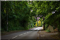
Upper Packington Road, Ashby-de-la-Zouch
Looking northwards, up a brief hill. The road crosses over the Leicester to Burton Railway, and eventually connects to Leicester Road.
Image: © Oliver Mills
Taken: 8 Jun 2020
0.05 miles
2
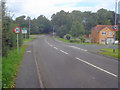
Entering Ashby
Heading north along Upper Packington Road. On the right is Chapmans Meadows and on the left beyond the town sign is Lower Packington Road. Although formally 'Ashby de la Zouch', the locals call it just plain 'Ashby'.
Image: © Trevor Rickard
Taken: 29 Aug 2009
0.08 miles
3
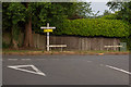
Junction between Upper and Lower Packington Road, Ashby
Viewed from Lower Packington Road, which continues right on the primary road. Upper Packington Road begins from this junction, and connects to Leicester Road further North.
Image: © Oliver Mills
Taken: 8 Jun 2020
0.08 miles
4
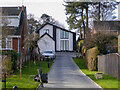
St Michael's Cottage, Upper Packington Road, Ashby-de-la-Zouch
Despite initial impressions, this seems to be one of the oldest properties in this part of Ashby. Before the 20th Century, the Cottage was the only dwelling on or around Windmill Hill, aside from the Windmill of its namesake and a small quarry used for the various Robert Chaplin-designed developments around Ashby in the early 19th Century (i.e. Ivanhoe Baths/Terrace, Royal Hotel). In the early 20th Century it was joined alongside by the "Red House", a large Edwardian manor which survived until the end of the 1960s. This plot, to the North of the Cottage, was subsequently redeveloped into St Michael's Close; followed by the plots to the South from the mid-1970s onwards. The entirety of Windmill Hill is now developed with housing, yet St Michael's Cottage still survived, making for an unexpected sight when its deeply recessed roadside view (as per this photograph) came into view. Surprisingly, the cottage's comprehensive reconstruction and extension into a contemporary-styled house was approved without mention or acknowledgement of its history. This has unfortunately meant that any surviving historical characteristics of the cottage have been permanently lost.
Image: © Oliver Mills
Taken: 5 Feb 2023
0.16 miles
5
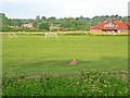
David Hunt Soccer School
Packington Road, Ashby-de-la-Zouch.
Image: © Oliver Dixon
Taken: 4 Jun 2006
0.19 miles
6
A42 bridge
Taking the Ashby Road over the dual carriageway.
Image: © Trevor Rickard
Taken: 29 Aug 2009
0.19 miles
7
Upper Packington Road
Looking north along this pleasant suburban road. Left is Pennine Way, right is Hastings Way.
Image: © Trevor Rickard
Taken: 29 Aug 2009
0.20 miles