IMAGES TAKEN NEAR TO
Rose Dene, STOURPORT-ON-SEVERN, DY13 8SU
Introduction
This page details the photographs taken nearby to Rose Dene, DY13 8SU by members of the Geograph project.
The Geograph project started in 2005 with the aim of publishing, organising and preserving representative images for every square kilometre of Great Britain, Ireland and the Isle of Man.

There are currently over 7.5m images from over14,400 individuals and you can help contribute to the project by visiting https://www.geograph.org.uk
Image Map
Images are licensed for reuse under creativecommons.org/licenses/by-sa/2.0
Notes
- Clicking on the map will re-center to the selected point.
- The higher the marker number, the further away the image location is from the centre of the postcode.
Image Listing (61 Images Found)
Images are licensed for reuse under creativecommons.org/licenses/by-sa/2.0
Image
Details
Distance
1
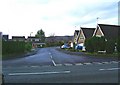
Ribbesford Drive
Modern housing on the Lickhill Estate. Many of the properties here are of the type on the right, with sharply sloping roofs, and consequently some of the bedrooms have sloping ceilings. In the foreground is part of Lower Lickhill Road. Image
Image: © P L Chadwick
Taken: 31 Dec 2009
0.08 miles
3
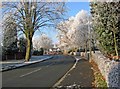
Frost on trees and hedge in Lower Lickhill Road
Most of the recent snow had disappeared, but a very heavy overnight frost resulted in most of the trees and hedges here being turned white.
Image: © P L Chadwick
Taken: 7 Dec 2010
0.10 miles
4
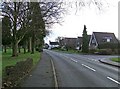
Lower Lickhill Road
On the left is Stourport War Memorial Park. On the right is the start of Stagborough Way, which is the main road through the Lickhill Estate, a post-war housing development. Lower Lickhill Road shortly becomes Lickhill Road.
Image: © P L Chadwick
Taken: 31 Dec 2009
0.10 miles
5
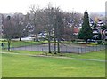
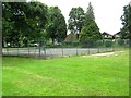
Stourport War Memorial Park - tennis courts
These are or were tennis courts, but the Town Council might convert them to a multi-use ball games area when funds permit. Update January 2019: The tennis courts have gone. Work began in late 2017 to install play equipment on part of the site where the courts were. The rest of the site has been grassed over.
Image: © P L Chadwick
Taken: 31 Dec 2009
0.11 miles
6
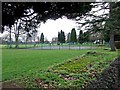
Stourport War Memorial Park - tennis courts
Photographed from Lower Lickhill Road. Another view:- Image
Update January 2019: The tennis courts have gone. Work began in late 2017 to install play equipment on part of the site where the courts were. The rest of the site has been grassed over.
Image: © P L Chadwick
Taken: 31 Dec 2009
0.11 miles
7
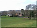
Stourport War Memorial Park looking towards Lower Lickhill Road
Part of this extensive public park, with part of the Community Centre car park on the right. Image
Image: © P L Chadwick
Taken: 31 Dec 2009
0.11 miles
8
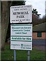
Signs in Stourport Community Centre Car Park
There is a small car park off Lower Lickhill Road by the Community Centre. These signs have been placed near the entrance. The top sign shows the park's name as Memorial Park, which is how most people refer to it. But elsewhere it is referred to as the War Memorial Park, and sometimes as the War Memorial Gardens. The lower sign gives the Community Centre address as Lickhill Road, although it's actually in Lower Lickhill Road. Image;Image
Image: © P L Chadwick
Taken: 31 Dec 2009
0.11 miles
9
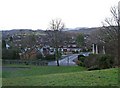
Stourport War Memorial Park looking towards Lickhill Estate
The northern part of this park is on a small hill, which gives some good views. This photograph shows part of the gardens, and beyond Lower Lickhill Road, Ribbesford Drive and part of the Lickhill Estate.
Image: © P L Chadwick
Taken: 31 Dec 2009
0.11 miles