
IMAGES TAKEN NEAR TO
Canterbury Street, COVENTRY, CV1 5NR
Introduction
This page details the photographs taken nearby to Canterbury Street, CV1 5NR by members of the Geograph project.
The Geograph project started in 2005 with the aim of publishing, organising and preserving representative images for every square kilometre of Great Britain, Ireland and the Isle of Man.

There are currently over 7.5m images from over14,400 individuals and you can help contribute to the project by visiting https://www.geograph.org.uk
Image Map
Images are licensed for reuse under creativecommons.org/licenses/by-sa/2.0
Notes
- Clicking on the map will re-center to the selected point.
- The higher the marker number, the further away the image location is from the centre of the postcode.
Image Listing (110 Images Found)
Images are licensed for reuse under creativecommons.org/licenses/by-sa/2.0
Image
Details
Distance
1
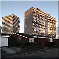
High rise Hillfields, seen from Kildale Close
During the 1960s redevelopment of Hillfields, a war-damaged 19th century industrial district, thirteen high rise housing blocks were built by the city of Coventry. Some have since been demolished; these are two of the survivors, with some more recent low-rise housing in the foreground.
The block on the right is Hillfields House on Yardley Street, with 52 homes on ten floors. It was built by Wimpey in 1960-61 to designs by the Coventry city architect's department under Arthur Ling https://www.towerblock.eca.ed.ac.uk/development/yardley-street .
On the left is Thomas King House on Wellington Street, with 128 dwellings on 17 storeys, built 1967-8 by British Lift Slab, to designs by the same team, by then led by Terence Gregory. https://www.towerblock.eca.ed.ac.uk/development/wellington-street .
Both links are to the Edinburgh University Tower Block site. For more on Hillfields, see the Coventry Society https://www.coventrysociety.org.uk/coventry-neighbourhoods/hillfields/ .
Image: © A J Paxton
Taken: 6 Jan 2024
0.07 miles
3
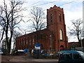
Coventry-Saint Peter's Church
In Charles Street Hillfields and dating from 1840. Appears to be undergoing building work at present.
Image: © Ian Rob
Taken: 7 Dec 2007
0.07 miles
4
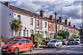
Vine Street
19th Century housing in Vine Street. The plaque on the house in the centre of photo reads Alma Cottage.
Image: © Ian Capper
Taken: 24 Sep 2021
0.08 miles
5
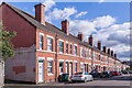
Vine Street
19th Century housing in Vine Street.
Image: © Ian Capper
Taken: 24 Sep 2021
0.09 miles
6
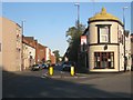
East on Raglan Street, Coventry
On the corner of Alma Street, right, is The Foresters public house. Raglan Street takes its name from Lord Raglan, a British commander in the Crimean War who won the battle of Alma, 1854; the street was presumably laid out soon after.
Image: © Robin Stott
Taken: 22 Sep 2013
0.10 miles
7
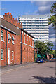
Charles Street
19th Century housing in Charles Street. Nos 1 - 3, in the centre of the photo, are grade II listed - see www.historicengland.org.uk/listing/the-list/list-entry/1076638. In the background is Thomas King House, a 17 storey block of flats completed in 1968.
Image: © Ian Capper
Taken: 24 Sep 2021
0.10 miles
8
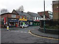
Coventry-Hillfields
Shops in Victoria Street.
Image: © Ian Rob
Taken: 7 Dec 2007
0.11 miles
9
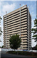
Thomas King House, Wellington Street, Coventry
One of a number of similarly-styled tower blocks dotted about the northern fringes of Coventry, standing like sentries as if to provide early warning of incursions by Nuneaton or Hinckley. They are distinguished by projecting white concrete bands and closely resemble designs by City Architect, Arthur Ling. Built by him or his successor, Terence Gregory, in the early-mid 1960s.
This one was about to be refurbished, including renewing interiors and the roof.
Image: © Stephen Richards
Taken: 22 Aug 2011
0.11 miles
10
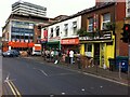
Victoria Street, Hillfields, Coventry
This part of Victoria Street forms the southern side of a square at the centre of the rather edgy social life of Hillfields. It was created as part of the 'regeneration' of the area at the tun of the century, when most of its thirteen tower blocks were demolished and replaced by low-rise housing. https://www.coventrysociety.org.uk/coventry-neighbourhoods/hillfields.html
In this row of buildings can be seen an Iranian delicatessen, the Persian Mini Market. Like many such specialist shops it has expanded its range to cater for other communities that live and shop locally; on its shelves I saw Riga herrings and tinned elk meat among more familiar Iranian foodstuffs. On this hot and humid July evening it was doing a brisk trade in melons. Beyond it can be seen two Kurdish shops, the Yosuf Bakery and the Kurdistan Coffee Shop.
The First and Best food store on the far side of Canterbury Street occupies the now very decrepit-looking premises built in the early 1960s by H E Phillips, a specialist ironmonger, whose sign is still visible on the first floor. This family firm traded in Hillfields for ninety years from 1915 (see this IPPR report pp6-7 https://www.ippr.org/files/images/media/files/publication/2011/05/making_sense_of_community_1272.pdf ), and its expertise and its pegboards hung with countless tools and other useful items have been much missed by Coventry people. Behind it stands Thomas King House, one of the surviving 1960s housing blocks.
Image: © A J Paxton
Taken: 22 Jul 2021
0.12 miles