Charles Street
Introduction
The photograph on this page of Charles Street by Ian Capper as part of the Geograph project.
The Geograph project started in 2005 with the aim of publishing, organising and preserving representative images for every square kilometre of Great Britain, Ireland and the Isle of Man.

There are currently over 7.5m images from over 14,400 individuals and you can help contribute to the project by visiting https://www.geograph.org.uk
Charles Street
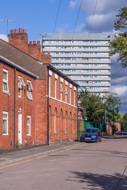
Image: © Ian Capper Taken: 24 Sep 2021
19th Century housing in Charles Street. Nos 1 - 3, in the centre of the photo, are grade II listed - see www.historicengland.org.uk/listing/the-list/list-entry/1076638. In the background is Thomas King House, a 17 storey block of flats completed in 1968.
Images are licensed for reuse under creativecommons.org/licenses/by-sa/2.0
Image Location
Latitude
52.41278
Longitude
-1.500949