High rise Hillfields, seen from Kildale Close
Introduction
The photograph on this page of High rise Hillfields, seen from Kildale Close by A J Paxton as part of the Geograph project.
The Geograph project started in 2005 with the aim of publishing, organising and preserving representative images for every square kilometre of Great Britain, Ireland and the Isle of Man.

There are currently over 7.5m images from over 14,400 individuals and you can help contribute to the project by visiting https://www.geograph.org.uk
High rise Hillfields, seen from Kildale Close
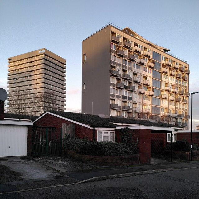
Image: © A J Paxton Taken: 6 Jan 2024
During the 1960s redevelopment of Hillfields, a war-damaged 19th century industrial district, thirteen high rise housing blocks were built by the city of Coventry. Some have since been demolished; these are two of the survivors, with some more recent low-rise housing in the foreground. The block on the right is Hillfields House on Yardley Street, with 52 homes on ten floors. It was built by Wimpey in 1960-61 to designs by the Coventry city architect's department under Arthur Ling https://www.towerblock.eca.ed.ac.uk/development/yardley-street . On the left is Thomas King House on Wellington Street, with 128 dwellings on 17 storeys, built 1967-8 by British Lift Slab, to designs by the same team, by then led by Terence Gregory. https://www.towerblock.eca.ed.ac.uk/development/wellington-street . Both links are to the Edinburgh University Tower Block site. For more on Hillfields, see the Coventry Society https://www.coventrysociety.org.uk/coventry-neighbourhoods/hillfields/ .
Images are licensed for reuse under creativecommons.org/licenses/by-sa/2.0
Image Location
Latitude
52.412338
Longitude
-1.498587