
IMAGES TAKEN NEAR TO
Woodmansterne Road, COULSDON, CR5 2DJ
Introduction
This page details the photographs taken nearby to Woodmansterne Road, CR5 2DJ by members of the Geograph project.
The Geograph project started in 2005 with the aim of publishing, organising and preserving representative images for every square kilometre of Great Britain, Ireland and the Isle of Man.

There are currently over 7.5m images from over14,400 individuals and you can help contribute to the project by visiting https://www.geograph.org.uk
Image Map
Images are licensed for reuse under creativecommons.org/licenses/by-sa/2.0
Notes
- Clicking on the map will re-center to the selected point.
- The higher the marker number, the further away the image location is from the centre of the postcode.
Image Listing (120 Images Found)
Images are licensed for reuse under creativecommons.org/licenses/by-sa/2.0
Image
Details
Distance
1

Coulsdon: Footpath towards Woodmansterne Road
Having crossed the railway bridge, the LOOP opens out again as Woodmansterne Road is reached, where a turn is made to the west, (left). See Image
Image: © Dr Neil Clifton
Taken: 24 Jul 2010
0.01 miles
2
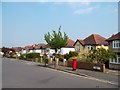
Woodmansterne Road, Coulsdon
On the London Loop path, this is part of a 2km-ish length of roadside walking as the route goes through Coulsdon.
Image: © Des Blenkinsopp
Taken: 23 May 2012
0.02 miles
3
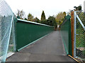
New bridge over railway
A replacement for an earlier bridge here.
Image: © Robin Webster
Taken: 21 Nov 2010
0.03 miles
4
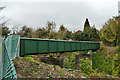
New bridge over railway
A replacement for an earlier bridge here. The old intermediate piers have been shunned and a single span used.
Image: © Robin Webster
Taken: 21 Nov 2010
0.04 miles
5
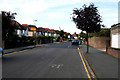
Coulsdon: Woodmansterne Road
The route of the LOOP follows this road westward until a half-right turn is made at the 'give-way' just visible on the right. See Image
Image: © Dr Neil Clifton
Taken: 24 Jul 2010
0.04 miles
6
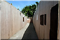
Coulsdon: Temporary footbridge across the Tattenham Corner railway
Looking north, the LOOP crosses this temporary footbridge, where oppressive wooden shuttering effectively prevents any view at all of the railway below. The bridge will, within the next six months, be replaced by a new one. See Image
Image: © Dr Neil Clifton
Taken: 24 Jul 2010
0.05 miles
7
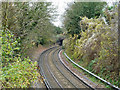
Railway up the Chipstead Valley
The branch to Tattenham Corner, which takes a sinuous course up the valley bottom. The bridge visible is disused.
Image: © Robin Webster
Taken: 21 Nov 2010
0.07 miles
8
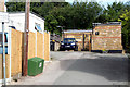
Coulsdon: Footpath off north side of Woodman Road
The London Loop follows this path northwards for a few yards, before making a left turn to the west. See Image
Image: © Dr Neil Clifton
Taken: 24 Jul 2010
0.07 miles
9
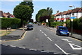
Coulsdon: Woodmansterne Road
Woodmansterne Road, and the route of the LOOP, make a subtle change of direction here, heading up the hill to reach the 'Jack and Jill', an appropriately named public house. The route crosses the boundary from the London Borough of Croydon into the London Borough of Sutton on the way.
Image: © Dr Neil Clifton
Taken: 24 Jul 2010
0.07 miles
10
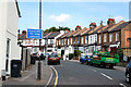
Coulsdon: Woodman Road
The clockwise walker on the London Loop should walk up this very minor road, looking for a signposted footpath to the right. See Image
Image: © Dr Neil Clifton
Taken: 24 Jul 2010
0.08 miles