
IMAGES TAKEN NEAR TO
Dullisk Way, NEWTOWNARDS, BT23 5DH
Introduction
This page details the photographs taken nearby to Dullisk Way, BT23 5DH by members of the Geograph project.
The Geograph project started in 2005 with the aim of publishing, organising and preserving representative images for every square kilometre of Great Britain, Ireland and the Isle of Man.

There are currently over 7.5m images from over14,400 individuals and you can help contribute to the project by visiting https://www.geograph.org.uk
Image Map
Images are licensed for reuse under creativecommons.org/licenses/by-sa/2.0
Notes
- Clicking on the map will re-center to the selected point.
- The higher the marker number, the further away the image location is from the centre of the postcode.
Image Listing (10 Images Found)
Images are licensed for reuse under creativecommons.org/licenses/by-sa/2.0
Image
Details
Distance
1
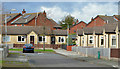
Crescent Grove, Comber (2)
See Image (May 2012). The ground-level view of this small cul-de-sac of bungalows off the Newtownards Road.
Image: © Albert Bridge
Taken: 23 Oct 2013
0.18 miles
2
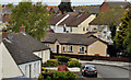
Crescent Grove, Comber
A street, mainly bungalows, off Bridge Street Image, seen from the relative heights of De Wind Drive. Image shows a different view in October 2013.
Image: © Albert Bridge
Taken: 15 May 2012
0.21 miles
3
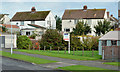
Garden building site, Comber
A garden, near the corner of Crescent Grove and Lower Crescent, described on the agents’ sign as a “building site” and “agreed”. This photograph appears as a matter of geographical and historical record only. I have no connection with any of the parties involved in the sale.
Image: © Albert Bridge
Taken: 23 Oct 2013
0.22 miles
4
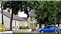
Old Forge Court, Comber
A small cul-de-sac of social housing on the eastern side of the Darragh Road.
Image: © Albert Bridge
Taken: 10 Aug 2013
0.23 miles
5
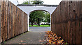
Footpath, Comber
Part of a footpath leading out to Lower Crescent.
Image: © Albert Bridge
Taken: 12 Oct 2011
0.23 miles
6

Low drumlins, Comber
The view from Castlelodge Park, across here Image and the Enler River Image, towards Scrabo Tower. The “vacant ground” looks very soft and lies below the old 50ft contour. The drumlins (middle) seem to be below the old 100ft contour.
Image: © Albert Bridge
Taken: 18 Sep 2013
0.24 miles
7
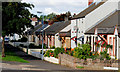
Lower Crescent, Comber
A street to the north of Bridge Street and the Newtownards Road. Sheltered from both by a line of trees (left).
Image: © Albert Bridge
Taken: 11 Sep 2010
0.24 miles
8
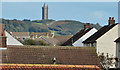
Rooftops, Comber
One of the side effects of Comber’s position among the drumlins of north Down is the chance to see the rooftops without recourse to a “cherry picker”. This view is from De Wind Drive, across the Newtownards Road, towards Scrabo Tower http://www.geograph.org.uk/snippet/7476.
Image: © Albert Bridge
Taken: 23 Oct 2013
0.24 miles
9
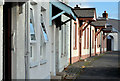
Lower Crescent, Comber (3)
Part of the terrace consisting of single and two-storey dwellings, with different styles of porches.
Image: © Albert Bridge
Taken: 23 Oct 2013
0.24 miles
10
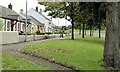
Lower Crescent, Comber (2)
The north eastern end of the street, greatly enhanced by the mature trees and possibly one of the most attractive examples of public-sector housing in NI.
Image: © Albert Bridge
Taken: 23 Oct 2013
0.25 miles