Rooftops, Comber
Introduction
The photograph on this page of Rooftops, Comber by Albert Bridge as part of the Geograph project.
The Geograph project started in 2005 with the aim of publishing, organising and preserving representative images for every square kilometre of Great Britain, Ireland and the Isle of Man.

There are currently over 7.5m images from over 14,400 individuals and you can help contribute to the project by visiting https://www.geograph.org.uk
Rooftops, Comber
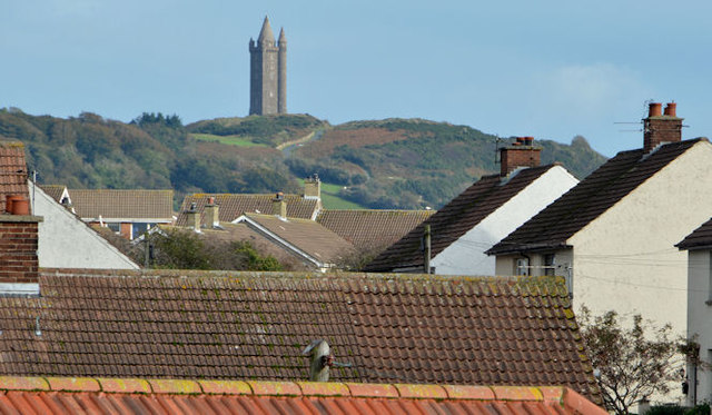
Image: © Albert Bridge Taken: 23 Oct 2013
One of the side effects of Comber’s position among the drumlins of north Down is the chance to see the rooftops without recourse to a “cherry picker”. This view is from De Wind Drive, across the Newtownards Road, towards Scrabo Tower http://www.geograph.org.uk/snippet/7476.
Images are licensed for reuse under creativecommons.org/licenses/by-sa/2.0
Image Location
Latitude
54.552374
Longitude
-5.738199