
IMAGES TAKEN NEAR TO
Fairfield Crescent, HASSOCKS, BN6 9SF
Introduction
This page details the photographs taken nearby to Fairfield Crescent, BN6 9SF by members of the Geograph project.
The Geograph project started in 2005 with the aim of publishing, organising and preserving representative images for every square kilometre of Great Britain, Ireland and the Isle of Man.

There are currently over 7.5m images from over14,400 individuals and you can help contribute to the project by visiting https://www.geograph.org.uk
Image Map
Images are licensed for reuse under creativecommons.org/licenses/by-sa/2.0
Notes
- Clicking on the map will re-center to the selected point.
- The higher the marker number, the further away the image location is from the centre of the postcode.
Image Listing (30 Images Found)
Images are licensed for reuse under creativecommons.org/licenses/by-sa/2.0
Image
Details
Distance
1
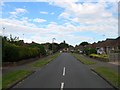
Fairfield Crescent, Hurstpierpoint
Small estate built in the late 1950s off Cuckfield Road and named after Image whose land the estate was built on. Both it and another road, St Lawrence Way were built on a field called Middle Piece according to Hurstpierpoint's 1842 tithe map which later became a brick field by the 1875 OS map but had disappeared by the following 1899 one.
Image: © Simon Carey
Taken: 6 Jul 2014
0.04 miles
2
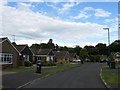
Wilderness Road, Hurstpierpoint
A looping road off marchants Road built in the late 1960s/early 1970s. Named after The Wilderness which is the wood beyond the estate.
Image: © Simon Carey
Taken: 6 Jul 2014
0.07 miles
3
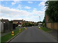
Marchants Road, Hurstpierpoint
Looking eastwards from the Cuckfield Road end. The junction with Image is to the left and Image to the right. The road then heads off to a junction with Trinity Road.
Image: © Simon Carey
Taken: 6 Jul 2014
0.12 miles
4
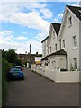
West House, Cuckfield Road, Hurstpierpoint
Formerly known as Fairfield and dating from the 19th century when it was the only building on the eastern side of Cuckfield Road between the village centre and Chalkers Lane, hence the fact it is at right angles with the road.
Image: © Simon Carey
Taken: 6 Jul 2014
0.12 miles
5
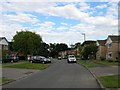
Iden Hurst, Hurstpierpoint
Part of a residential estate built in the early 1970s on a former field called Home Mead, according to Hurstpierpoint's 1842 tithe map. There are three small cup de sacs off this road, Image, Image and Image
Image: © Simon Carey
Taken: 6 Jul 2014
0.13 miles
6
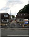
New Development, Cuckfield Road, Hurstpierpoint
Being built to the rear of the two bungalows is a small cup de sac which if I think is going to be called Sycamore Close.
Image: © Simon Carey
Taken: 6 Jul 2014
0.14 miles
8
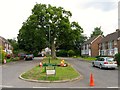
St Christopher's Road, Hurstpierpoint
Small cul de sac off Marchants Road built in the late 60s/early 70s. Beyond the fence is the ground of St Lawrence's School.
Image: © Simon Carey
Taken: 6 Jul 2014
0.15 miles
9
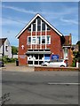
Methodist Church, Cuckfield Road, Hurstpierpoint
Built between the wars.
Image: © Simon Carey
Taken: 17 Jul 2014
0.16 miles
10
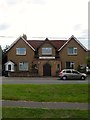
St Luke's Roman Catholic Church, Cuckfield Road, Hurstpierpoint
Originally built as a mission room in the first decade of the 20th century which explains why the church seems to have been built between two houses. It became a Roman Catholic church between the wars.
Image: © Simon Carey
Taken: 6 Jul 2014
0.16 miles