St Luke's Roman Catholic Church, Cuckfield Road, Hurstpierpoint
Introduction
The photograph on this page of St Luke's Roman Catholic Church, Cuckfield Road, Hurstpierpoint by Simon Carey as part of the Geograph project.
The Geograph project started in 2005 with the aim of publishing, organising and preserving representative images for every square kilometre of Great Britain, Ireland and the Isle of Man.

There are currently over 7.5m images from over 14,400 individuals and you can help contribute to the project by visiting https://www.geograph.org.uk
St Luke's Roman Catholic Church, Cuckfield Road, Hurstpierpoint
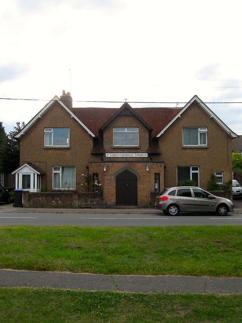
Image: © Simon Carey Taken: 6 Jul 2014
Originally built as a mission room in the first decade of the 20th century which explains why the church seems to have been built between two houses. It became a Roman Catholic church between the wars.
Images are licensed for reuse under creativecommons.org/licenses/by-sa/2.0
Image Location
Latitude
50.939858
Longitude
-0.179138