1
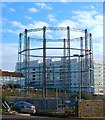
Black Rock Gasholder
The gasholder has been disused since the 1960's
Image: © Paul Gillett
Taken: 4 Mar 2017
0.03 miles
2
Marina Way
Opened in 1976 to provide access to the newly built Brighton Marina. Its construction involved the demolition of the small community of houses erected in 1860 at Rifle Butt Road which the new access route considerable widened and deepened. All that survives is the gas holder. The fire engine is probably returning to the station round the corner at Roedean whilst in the distance Wilson Avenue and the suburb of Whitehawk can be seen.
Image: © Simon Carey
Taken: 11 Jan 2009
0.03 miles
3
Roedean Road, Black Rock, Brighton
The B2118 runs from the junction with Arundel Road and Whitehawk Road, the junction's traffic lights can be seen ahead, eastwards to Marine Drive, the A259. It was constructed in 1897 when the former coast road was made unsafe by a series of cliff collapses at Black Rock and became part of the main route eastwards out of Brighton. After Brighton council acquired the parishes of Ovingdean and Rottingdean in 1928 it began construction in 1930 of a set of sea defences later known as the Undercliff Walk. With cliffs now stabilised it also reconstructed the coast road which opened in 1932 reducing the importance of this road. Originally known as Rottingdean Road until 1932 when it acquired its current name. In the distance straight ahead is Thomas Kemp Tower, part of the Royal Sussex County Hospital complex, whilst to its right are the flats that form part of the Manor Hill Estate.
Image: © Simon Carey
Taken: 23 Dec 2015
0.03 miles
4
Gasholder, Kemp Town, Brighton
Image: © Robin Webster
Taken: 2 Mar 2010
0.04 miles
5
Cliff Road, Black Rock, Brighton
Laid out around 1910 though not developed until after the First World War. Originally the road ran south to the cliffs but was truncated due to the construction of Marine Drive in 1932 and Marine Gate in 1939. Beyond is
Image
Image: © Simon Carey
Taken: 23 Dec 2015
0.04 miles
6
Roedean fire station
Roedean fire station, Roedean Road, Brighton, East Sussex
Image: © Kevin Hale
Taken: 16 Jun 2007
0.04 miles
7
Black Rock Gas Holder
Viewed from Roedean Road and marking the site where the first gas works of Brighton were constructed, initially just over the boundary in the parish of Ovingdean to avoid a local tax on coal. The site continued producing gas until 1885 when production was concentrated in Portslade and Black Rock was reduced to a storage facility which it still retains today. The building in the background to the left is Marine Gate, both that and the holder were hit by bombs during the Second World war.
Image: © Simon Carey
Taken: 29 Aug 2011
0.04 miles
8
Gas works site
There seem to be fewer gas holders now than on the map, so I guess the site is being redeveloped
Image: © Keith Edkins
Taken: 21 Sep 2012
0.04 miles
9
Black Rock Gas Holder, Brighton
The gas holder occupies the site of Brighton's first gasworks built in 1818-19 just over the parish boundary in neighbouring Rottingdean in order to avoid paying a local levy on imported coal. The works remained here until the 1880s when the expanding company moved to larger premises at Portslade in Shoreham Harbour with the site used for storage only. The three holders were often targets for the Luftwaffe during World War Two who scored a direct hit during the conflict and a near miss in 1944 which resulted in Marina Gate beyond getting hit instead. Much of the former gas works were demolished in the 1960s with a couple of gas holders removed a decade or so later. British Gas still occupy the northern part of the yard using it as a small depot though it appears the local council are the freeholders. The site is part of the Marina redevelopment plan though high levels of contamination mean it is earmarked for industrial uses.
Image: © Simon Carey
Taken: 13 Nov 2015
0.05 miles
10
Roedean Road, Black Rock, Brighton
The B2118 viewed from the junction of Arundel Road, Whitehawk Road and Bristol Gardens. The road was built in 1897 as a replacement for the old cliff top highway that had been lost to erosion and remained the main eastern route out of town until Marine Drive was opened in 1932. On the right is
Image with
Image beyond.
Image: © Simon Carey
Taken: 13 Nov 2015
0.05 miles


