Marina Way
Introduction
The photograph on this page of Marina Way by Simon Carey as part of the Geograph project.
The Geograph project started in 2005 with the aim of publishing, organising and preserving representative images for every square kilometre of Great Britain, Ireland and the Isle of Man.

There are currently over 7.5m images from over 14,400 individuals and you can help contribute to the project by visiting https://www.geograph.org.uk
Marina Way
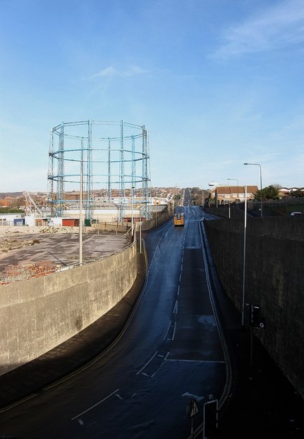
Image: © Simon Carey Taken: 11 Jan 2009
Opened in 1976 to provide access to the newly built Brighton Marina. Its construction involved the demolition of the small community of houses erected in 1860 at Rifle Butt Road which the new access route considerable widened and deepened. All that survives is the gas holder. The fire engine is probably returning to the station round the corner at Roedean whilst in the distance Wilson Avenue and the suburb of Whitehawk can be seen.
Images are licensed for reuse under creativecommons.org/licenses/by-sa/2.0
Image Location
Latitude
50.816002
Longitude
-0.104602