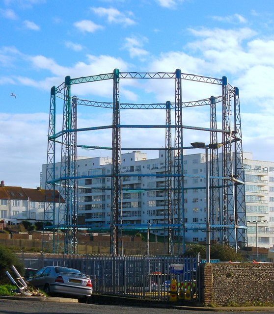
Black Rock Gas Holder, Brighton
Introduction
The photograph on this page of Black Rock Gas Holder, Brighton by Simon Carey as part of the Geograph project.
The Geograph project started in 2005 with the aim of publishing, organising and preserving representative images for every square kilometre of Great Britain, Ireland and the Isle of Man.
There are currently over 7.5m images from over 14,400 individuals and you can help contribute to the project by visiting https://www.geograph.org.uk

Image: © Simon Carey Taken: 13 Nov 2015
The gas holder occupies the site of Brighton's first gasworks built in 1818-19 just over the parish boundary in neighbouring Rottingdean in order to avoid paying a local levy on imported coal. The works remained here until the 1880s when the expanding company moved to larger premises at Portslade in Shoreham Harbour with the site used for storage only. The three holders were often targets for the Luftwaffe during World War Two who scored a direct hit during the conflict and a near miss in 1944 which resulted in Marina Gate beyond getting hit instead. Much of the former gas works were demolished in the 1960s with a couple of gas holders removed a decade or so later. British Gas still occupy the northern part of the yard using it as a small depot though it appears the local council are the freeholders. The site is part of the Marina redevelopment plan though high levels of contamination mean it is earmarked for industrial uses.

