Roedean Road, Black Rock, Brighton
Introduction
The photograph on this page of Roedean Road, Black Rock, Brighton by Simon Carey as part of the Geograph project.
The Geograph project started in 2005 with the aim of publishing, organising and preserving representative images for every square kilometre of Great Britain, Ireland and the Isle of Man.

There are currently over 7.5m images from over 14,400 individuals and you can help contribute to the project by visiting https://www.geograph.org.uk
Roedean Road, Black Rock, Brighton
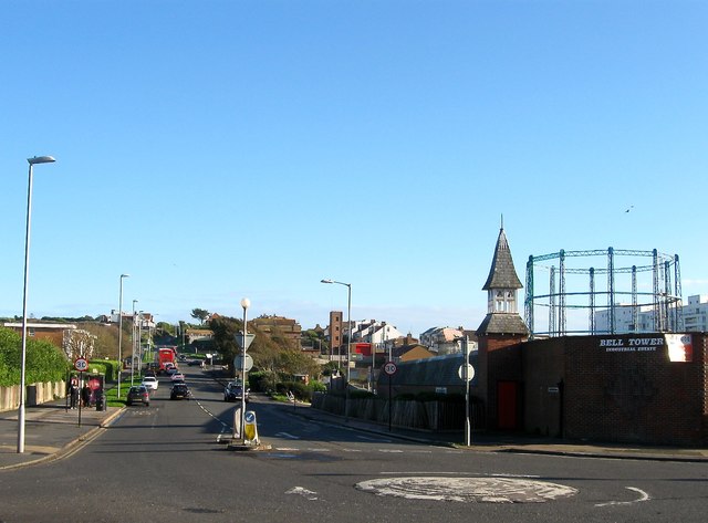
Image: © Simon Carey Taken: 13 Nov 2015
The B2118 viewed from the junction of Arundel Road, Whitehawk Road and Bristol Gardens. The road was built in 1897 as a replacement for the old cliff top highway that had been lost to erosion and remained the main eastern route out of town until Marine Drive was opened in 1932. On the right is Image with Image beyond.
Images are licensed for reuse under creativecommons.org/licenses/by-sa/2.0
Image Location
Latitude
50.816991
Longitude
-0.104562