
IMAGES TAKEN NEAR TO
Rustic Road, PEACEHAVEN, BN10 7SS
Introduction
This page details the photographs taken nearby to Rustic Road, BN10 7SS by members of the Geograph project.
The Geograph project started in 2005 with the aim of publishing, organising and preserving representative images for every square kilometre of Great Britain, Ireland and the Isle of Man.

There are currently over 7.5m images from over14,400 individuals and you can help contribute to the project by visiting https://www.geograph.org.uk
Image Map
Images are licensed for reuse under creativecommons.org/licenses/by-sa/2.0
Notes
- Clicking on the map will re-center to the selected point.
- The higher the marker number, the further away the image location is from the centre of the postcode.
Image Listing (27 Images Found)
Images are licensed for reuse under creativecommons.org/licenses/by-sa/2.0
Image
Details
Distance
1
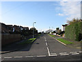
Rustic Road, Peacehaven
One of the original roads laid out in the 1920s when the settlement was developed and like the majority of roads in Peacehaven development was sparse and the road was unmade until much of north Peacehaven was redeveloped in the early 1980s. Consequently the smaller empty plots were built upon whilst the larger ones were made into new closes.
Image: © Simon Carey
Taken: 27 Oct 2012
0.01 miles
2
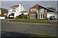
Greenwich Meridian crossing Rustic Rd going north
This picture was taken standing on the Bradley Greenwich meridian looking North. The meridian passes straight through the middle, see this http://www.riddlerworld.co.uk/meridian/PG0249.htm for an alternate image with the meridian superimposed as a green line. The meridian crosses Rustic rd and clips the corner of the house on the right.
Image: © steve ridley
Taken: 22 Jan 2011
0.03 miles
3
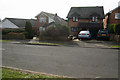
Greenwich Meridian crossing Rustic Rd going south
This picture was taken standing on the Bradley Greenwich meridian looking South. The meridian passes straight through the middle, see this http://www.riddlerworld.co.uk/meridian/PG0251.htm for an alternate image with the meridian superimposed as a green line. The meridian crosses Rustic rd going south and passes through the house 2nd from the left.
Image: © steve ridley
Taken: 22 Jan 2011
0.04 miles
4
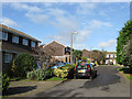
Rustic Park, Telscombe Cliffs
Lying at the end of Image it was added sometime during the 1980s to fill the gap next to the new development on the adjacent Kirby Drive.
Image: © Simon Carey
Taken: 27 Oct 2012
0.06 miles
5
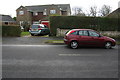
Greenwich meridian crossing Telscombe road
This picture was taken standing on the Bradley Greenwich meridian looking South. The meridian passes straight through the middle, see this http://www.riddlerworld.co.uk/meridian/PG0263.htm for an alternate image with the meridian superimposed as a green line. The meridian crosses Telscombe road and passes between the two cars in this picture and through the house with the red garage door.
Image: © steve ridley
Taken: 22 Jan 2011
0.06 miles
6
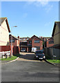
The Martins, Telscombe Cliffs
Small cul de sac squeezed between Kirby Drive and a small hillock known as Heathy Brow. The rise marks the old parochial boundary between Telscombe and Piddinghoe and the current one between the settlements of Telscombe Cliffs and Peacehaven.
Image: © Simon Carey
Taken: 27 Oct 2012
0.08 miles
7
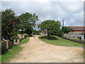
Tor Road West
Another of the remaining unmade roads in Peacehaven. Tor Road was originally planned to flank Image an open green space and ran from Phyllis Avenue in the west to Roderick Avenue to the east. These plans did not come off and for a while both sections of the road were actually linked via a track until that too disappeared when The Oval became a proper public open space. This view looks toward the junction with Downs Walk, formerly the northern section of Phyllis Avenue.
Image: © Simon Carey
Taken: 9 Jun 2012
0.08 miles
8
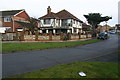
Greenwich Meridian crossing Downs walk
This picture was taken standing on the Bradley Greenwich meridian looking North. The meridian passes straight through the middle, see this http://www.riddlerworld.co.uk/meridian/PG0233.htm for an alternate image with the meridian superimposed as a green line. The meridian crosses Downs Walk and goes straight through the house in the middle of this picture.
Image: © steve ridley
Taken: 21 Jan 2011
0.10 miles
9
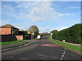
Kirby Drive, Telscombe Cliffs
This part of the road was originally the northern end of Ambleside Avenue but was widened and given a new designation when the housing estate built round the road on land that once belonged to Kirby Farm was developed in the early 1980s. It is now the main arterial road for the estates at the northern end of Telscombe Cliffs and Peacehaven.
Image: © Simon Carey
Taken: 27 Oct 2012
0.10 miles
10
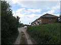
Downs Walk
The road was originally known as Phyllis Avenue but was changed to avoid confusion after the section south of Firle Road was cut off from that north of Heathy Brow that was laid out in the early 1980s. The change seems to have been carried out sometime in the last twenty years. This view looks from the point where the rough track becomes a proper road near to the junction with Telscombe Road.
Image: © Simon Carey
Taken: 9 Jun 2012
0.11 miles