Tor Road West
Introduction
The photograph on this page of Tor Road West by Simon Carey as part of the Geograph project.
The Geograph project started in 2005 with the aim of publishing, organising and preserving representative images for every square kilometre of Great Britain, Ireland and the Isle of Man.

There are currently over 7.5m images from over 14,400 individuals and you can help contribute to the project by visiting https://www.geograph.org.uk
Tor Road West
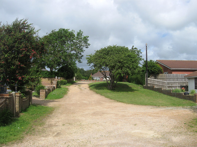
Image: © Simon Carey Taken: 9 Jun 2012
Another of the remaining unmade roads in Peacehaven. Tor Road was originally planned to flank Image an open green space and ran from Phyllis Avenue in the west to Roderick Avenue to the east. These plans did not come off and for a while both sections of the road were actually linked via a track until that too disappeared when The Oval became a proper public open space. This view looks toward the junction with Downs Walk, formerly the northern section of Phyllis Avenue.
Images are licensed for reuse under creativecommons.org/licenses/by-sa/2.0
Image Location
Latitude
50.805357
Longitude
-0.000288