1
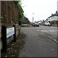
Endfield Road, Bournemouth
This is the view south of these 1930's houses in Endfield Rd close to the junction with Coronation Avenue.
Image: © Nigel Mykura
Taken: 28 Aug 2009
0.05 miles
2
Moordown: Church of the Nazarene
A small church on the corner of Mayfield Road (ahead and behind) and Queen Mary Avenue (left and right). The 1975 Kelly's Directory lists it as the Andrew Vine Memorial Church of the Nazarene, but I can find no mention of Andrew Vine today.
Image: © Chris Downer
Taken: 24 Feb 2008
0.05 miles
3
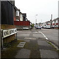
Moordown: Mayfield Road
Mayfield Road comes towards the camera from Coronation Road and crosses the three 'royal' avenues – Queen Mary, King George and King Edward – before turning a slight bend to end on Malvern Road. That last segment, distant behind us, was called Clarkson Road until about the mid-1930s.
The sign is a modern one, from 2010-15 when this more modern, abstract emblem rather than the traditional town coat of arms as the working logo of the council.
This is photo no.265 of a series of 453 in my coronavirus lockdown walking project:
See https://www.geograph.org.uk/article/My-2020-Coronavirus-Lockdown-walking-project for the complete set of photos.
Image: © Chris Downer
Taken: 18 Apr 2020
0.08 miles
4
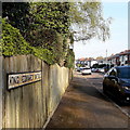
Moordown: King George Avenue
The middle of three parallel monarchical avenues in Moordown, sandwiched between King Edward and Queen Mary Avenues. They comprise typical Moordown housing - decent detached houses from the reign of Edward and the Georges in the 20th century.
The sign is the standard Bournemouth nameplate from the 1980s, affixed with tubular steel which protrudes at each side.
This is photo no.222 of a series of 453 in my coronavirus lockdown walking project:
See https://www.geograph.org.uk/article/My-2020-Coronavirus-Lockdown-walking-project for the complete set of photos.
Image: © Chris Downer
Taken: 18 Apr 2020
0.09 miles
5
Moordown: King Edward Avenue
One of three consecutive monarchical avenues in Moordown, King George and Queen Mary Avenues being parallel to the south. They comprise typical Moordown housing - decent detached houses from the reign of Edward and the Georges in the 20th century.
The sign is an old cast-iron one from the 1950s, not exactly a rarity but nice to see surviving, refixed to a more modern fence.
This is photo no.221 of a series of 453 in my coronavirus lockdown walking project:
See https://www.geograph.org.uk/article/My-2020-Coronavirus-Lockdown-walking-project for the complete set of photos.
Image: © Chris Downer
Taken: 12 Apr 2020
0.09 miles
6
Pavilion - Moordown Recreation Ground
Image: © David Lally
Taken: 10 Apr 2016
0.10 miles
7
Moordown: postbox № BH9 134, Limited Road
Looking along Limited Road, a small residential street, from its western end.
This George V-reign postbox is my local one. Returning home from a fortnight's holiday a couple of years ago, I came here to post a letter only to find a square of tarmac where the postbox had stood – I am pleased to report it was reinstated a few months later.
Image: © Chris Downer
Taken: 3 Jul 2008
0.12 miles
8
Moordown: snow-capped postbox
Image does not often have this appearance; it followed Bournemouth's heaviest snowfall for some years, occurring overnight and today. The picture was taken at about 10 o'clock in the evening.
Image: © Chris Downer
Taken: 2 Feb 2009
0.12 miles
9
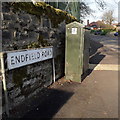
Moordown: Endfield Road
This looks as if it might be a misspelling of Enfield, but in fact it is at the end of the field – the field being Moordown Recreation Ground, which is the other side of the wall.
The sign looks like the standard Bournemouth nameplate from the 1980s, affixed with tubular steel which protrudes at each side, but actually the angle of the sun right now is perfect to show that it is in fact an older version, the lettering being embossed rather than adhesive.
This is photo no.132 of a series of 453 in my coronavirus lockdown walking project:
See https://www.geograph.org.uk/article/My-2020-Coronavirus-Lockdown-walking-project for the complete set of photos.
Image: © Chris Downer
Taken: 12 Apr 2020
0.12 miles
10
Coronation Avenue Bournemouth
View east along this quiet residential street of solidly built victorian red brick houses.
Image: © Nigel Mykura
Taken: 28 Aug 2009
0.13 miles


