Moordown: Church of the Nazarene
Introduction
The photograph on this page of Moordown: Church of the Nazarene by Chris Downer as part of the Geograph project.
The Geograph project started in 2005 with the aim of publishing, organising and preserving representative images for every square kilometre of Great Britain, Ireland and the Isle of Man.

There are currently over 7.5m images from over 14,400 individuals and you can help contribute to the project by visiting https://www.geograph.org.uk
Moordown: Church of the Nazarene
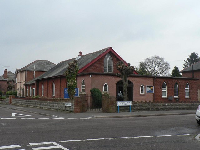
Image: © Chris Downer Taken: 24 Feb 2008
A small church on the corner of Mayfield Road (ahead and behind) and Queen Mary Avenue (left and right). The 1975 Kelly's Directory lists it as the Andrew Vine Memorial Church of the Nazarene, but I can find no mention of Andrew Vine today.
Images are licensed for reuse under creativecommons.org/licenses/by-sa/2.0
Image Location
Latitude
50.751382
Longitude
-1.873931