Moordown: Endfield Road
Introduction
The photograph on this page of Moordown: Endfield Road by Chris Downer as part of the Geograph project.
The Geograph project started in 2005 with the aim of publishing, organising and preserving representative images for every square kilometre of Great Britain, Ireland and the Isle of Man.

There are currently over 7.5m images from over 14,400 individuals and you can help contribute to the project by visiting https://www.geograph.org.uk
Moordown: Endfield Road
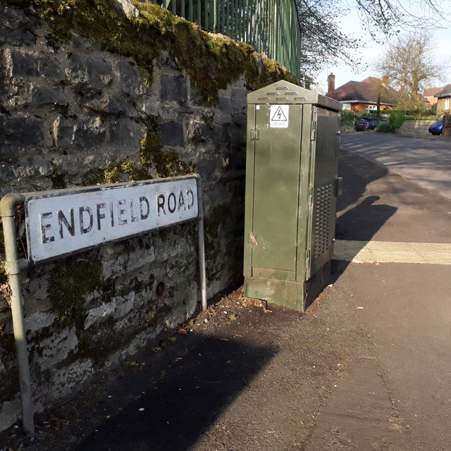
Image: © Chris Downer Taken: 12 Apr 2020
This looks as if it might be a misspelling of Enfield, but in fact it is at the end of the field – the field being Moordown Recreation Ground, which is the other side of the wall. The sign looks like the standard Bournemouth nameplate from the 1980s, affixed with tubular steel which protrudes at each side, but actually the angle of the sun right now is perfect to show that it is in fact an older version, the lettering being embossed rather than adhesive. This is photo no.132 of a series of 453 in my coronavirus lockdown walking project: See https://www.geograph.org.uk/article/My-2020-Coronavirus-Lockdown-walking-project for the complete set of photos.
Images are licensed for reuse under creativecommons.org/licenses/by-sa/2.0
Image Location
Latitude
50.752099
Longitude
-1.871236