Moordown: Mayfield Road
Introduction
The photograph on this page of Moordown: Mayfield Road by Chris Downer as part of the Geograph project.
The Geograph project started in 2005 with the aim of publishing, organising and preserving representative images for every square kilometre of Great Britain, Ireland and the Isle of Man.

There are currently over 7.5m images from over 14,400 individuals and you can help contribute to the project by visiting https://www.geograph.org.uk
Moordown: Mayfield Road
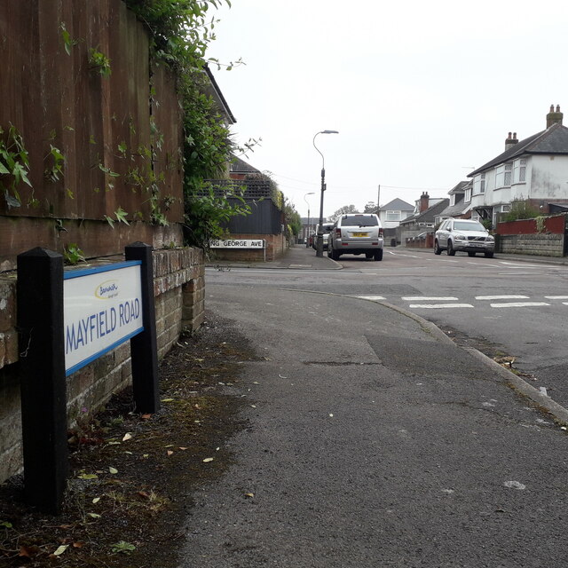
Image: © Chris Downer Taken: 18 Apr 2020
Mayfield Road comes towards the camera from Coronation Road and crosses the three 'royal' avenues – Queen Mary, King George and King Edward – before turning a slight bend to end on Malvern Road. That last segment, distant behind us, was called Clarkson Road until about the mid-1930s. The sign is a modern one, from 2010-15 when this more modern, abstract emblem rather than the traditional town coat of arms as the working logo of the council. This is photo no.265 of a series of 453 in my coronavirus lockdown walking project: See https://www.geograph.org.uk/article/My-2020-Coronavirus-Lockdown-walking-project for the complete set of photos.
Images are licensed for reuse under creativecommons.org/licenses/by-sa/2.0
Image Location
Latitude
50.751832
Longitude
-1.873788