Moordown: King Edward Avenue
Introduction
The photograph on this page of Moordown: King Edward Avenue by Chris Downer as part of the Geograph project.
The Geograph project started in 2005 with the aim of publishing, organising and preserving representative images for every square kilometre of Great Britain, Ireland and the Isle of Man.

There are currently over 7.5m images from over 14,400 individuals and you can help contribute to the project by visiting https://www.geograph.org.uk
Moordown: King Edward Avenue
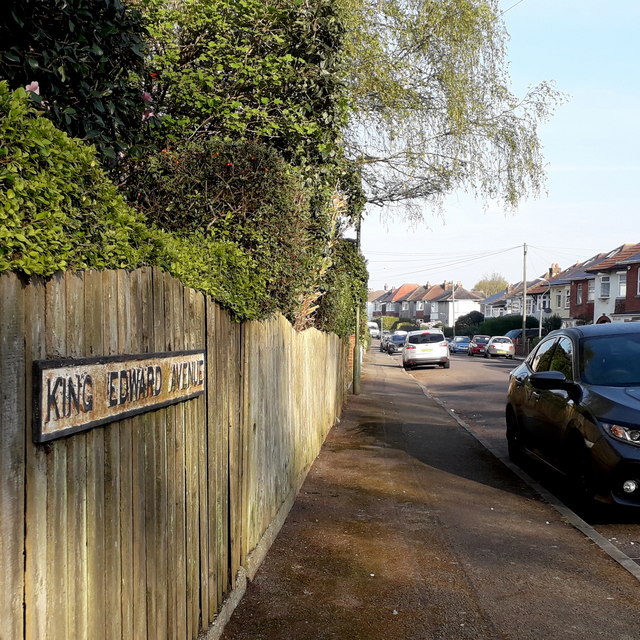
Image: © Chris Downer Taken: 12 Apr 2020
One of three consecutive monarchical avenues in Moordown, King George and Queen Mary Avenues being parallel to the south. They comprise typical Moordown housing - decent detached houses from the reign of Edward and the Georges in the 20th century. The sign is an old cast-iron one from the 1950s, not exactly a rarity but nice to see surviving, refixed to a more modern fence. This is photo no.221 of a series of 453 in my coronavirus lockdown walking project: See https://www.geograph.org.uk/article/My-2020-Coronavirus-Lockdown-walking-project for the complete set of photos.
Images are licensed for reuse under creativecommons.org/licenses/by-sa/2.0
Image Location
Latitude
50.75201
Longitude
-1.872228