
IMAGES TAKEN NEAR TO
Ibbertson Way, BOURNEMOUTH, BH8 0JF
Introduction
This page details the photographs taken nearby to Ibbertson Way, BH8 0JF by members of the Geograph project.
The Geograph project started in 2005 with the aim of publishing, organising and preserving representative images for every square kilometre of Great Britain, Ireland and the Isle of Man.

There are currently over 7.5m images from over14,400 individuals and you can help contribute to the project by visiting https://www.geograph.org.uk
Image Map
Images are licensed for reuse under creativecommons.org/licenses/by-sa/2.0
Notes
- Clicking on the map will re-center to the selected point.
- The higher the marker number, the further away the image location is from the centre of the postcode.
Image Listing (49 Images Found)
Images are licensed for reuse under creativecommons.org/licenses/by-sa/2.0
Image
Details
Distance
1
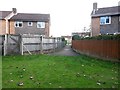
Townsend: footpath K36 to Ibbertson Way
This short public footpath leads from Ibbertson Way onto the public open space behind the houses. Here, we look onto the start of the path from the open space.
See Image for the view towards us from a little way along the path.
Image: © Chris Downer
Taken: 16 Oct 2016
0.01 miles
2
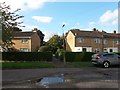
Townsend: footpath K36 from Ibbertson Way
Looking across the carriageway of Ibbertson Way and along this short public footpath, which leads onto the public open space behind the houses.
See Image for the view along the path from by the lamppost.
Image: © Chris Downer
Taken: 16 Oct 2016
0.01 miles
3
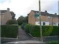
Townsend: footpath K36 is signposted to Open Space
Looking along this short public footpath, which leads from Ibbertson Way onto the public open space behind the houses.
See Image for the wider view from across the road behind us, and Image for the view towards us from along the path.
Image: © Chris Downer
Taken: 16 Oct 2016
0.02 miles
4
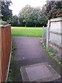
Townsend: footpath K36 reaches the open space
This short public footpath leads from Ibbertson Way onto the public open space behind the houses. Here, we look onto the open space from the end of the footpath.
See Image for the view towards us from ahead, and Image for the view behind us.
Image: © Chris Downer
Taken: 16 Oct 2016
0.02 miles
5
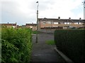
Townsend: footpath K36 arrives on Ibbertson Way
This short public footpath leads from Ibbertson Way onto the public open space behind the houses. Here, we look in the opposite direction, emerging onto Ibbertson Way. Opposite are the backyards of houses in Ibbertson Road, the more major road beyond.
See Image for the view towards us from ahead, and Image for the view behind us onto the open space.
Image: © Chris Downer
Taken: 16 Oct 2016
0.02 miles
6
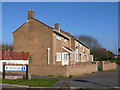
Ibbertson Way
This is a small "T" shaped cul-de-sac just off Ibbertson Road in Castle Point. The relatively recent terraced houses are probably social housing.
Image: © Nigel Mykura
Taken: 15 Nov 2011
0.03 miles
7
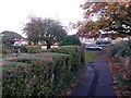
Townsend: footpath K37 approaches Ibbertson Way
At the dead end of Barrow Drive (behind us), the pavement continues to form public footpath K37 to Ibbertson Way, just ahead, another side street whose dead end is very close by - so much so that the houses of both roads form a virtually unbroken row (curving round to the left just out of picture).
See Image for a view towards us from the road ahead, and Image for the view onto Barrow Drive behind us.
Image: © Chris Downer
Taken: 16 Oct 2016
0.03 miles
8
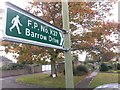
Townsend: sign for footpath K37
At the dead end of Ibbertson Way, here, the public footpath heads off at right angles and leads the short distance to Barrow Drive, whose dead end is in the background - the houses of both roads form a virtually unbroken row (curving round to the right).
Due to confined space and the height of the sign up the lamppost, I have had to hold the camera at full stretch above my head - see Image for a slightly more natural view along the path.
Image: © Chris Downer
Taken: 16 Oct 2016
0.03 miles
9
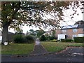
Townsend: footpath K37 from Ibbertson Way
At the dead end of Ibbertson Way, here, the public footpath heads off at right angles and leads the short distance to Barrow Drive, whose dead end is in the background - the houses of both roads form a virtually unbroken row (curving round to the right).
See Image for a view of the signpost for the footpath, and Image for the view towards us from along the path.
Image: © Chris Downer
Taken: 16 Oct 2016
0.03 miles
10
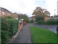
Townsend: footpath K37 from Barrow Drive
Barrow Drive is a side street, off Barrow Way, at the edge of the relatively modern Townsend estate. Here at the dead end, the pavement continues to form public footpath K37 to Ibbertson Way, another side street whose dead end is very close by - so much so that the houses of both roads form a virtually unbroken row.
See Image for a view towards us from behind, and Image for the view towards us from along the path ahead.
Image: © Chris Downer
Taken: 16 Oct 2016
0.04 miles