
IMAGES TAKEN NEAR TO
Chaseside, BOURNEMOUTH, BH7 7BX
Introduction
This page details the photographs taken nearby to Chaseside, BH7 7BX by members of the Geograph project.
The Geograph project started in 2005 with the aim of publishing, organising and preserving representative images for every square kilometre of Great Britain, Ireland and the Isle of Man.

There are currently over 7.5m images from over14,400 individuals and you can help contribute to the project by visiting https://www.geograph.org.uk
Image Map
Images are licensed for reuse under creativecommons.org/licenses/by-sa/2.0
Notes
- Clicking on the map will re-center to the selected point.
- The higher the marker number, the further away the image location is from the centre of the postcode.
Image Listing (46 Images Found)
Images are licensed for reuse under creativecommons.org/licenses/by-sa/2.0
Image
Details
Distance
1
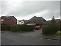
Bournemouth, Littledown Surgery
Littledown is a mainly residential suburb of western Bournemouth. Anyone interested in the health of the area's residents need look no further than this surgery's "QOF" (Quality & Outcomes Framework);
http://www.gpcontract.co.uk/surgery.php?orgcode=J81067
Image: © Mike Faherty
Taken: 12 Dec 2008
0.02 miles
2
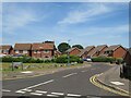
Springbank Road, Littledown, Bournemouth
Springbank Road forms part of a modern housing development in Littledown, in the north-eastern suburbs of Bournemouth.
Image: © Malc McDonald
Taken: 21 Jun 2022
0.05 miles
3
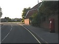
Littledown: postbox № BH7 84, Harewood Crescent
A modern postbox on this small, recent housing estate – dating from the late 1980s – of which Harewood Crescent is the main thoroughfare.
Image: © Chris Downer
Taken: 13 Jul 2008
0.06 miles
4
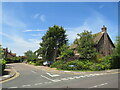
Walsingham Dene, Littledown, Bournemouth
Walsingham Dene forms part of a modern housing development in Littledown, in the north-eastern suburbs of Bournemouth.
Image: © Malc McDonald
Taken: 21 Jun 2022
0.08 miles
5
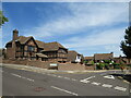
Elmgate Drive, Littledown, Bournemouth
Elmgate Drive forms part of a modern housing development in Littledown, in the north-eastern suburbs of Bournemouth.
Image: © Malc McDonald
Taken: 21 Jun 2022
0.10 miles
6
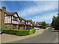
Elmgate Drive, Littledown, Bournemouth
Elmgate Drive forms part of a modern housing development in Littledown, in the north-eastern suburbs of Bournemouth.
Image: © Malc McDonald
Taken: 21 Jun 2022
0.13 miles
7
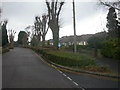
Bournemouth Harewood Road, bungalows
Littledown became available for housing development in the 1930s; this stretch of Harewood Road is lined with bungalows. Note the pollarded trees.
Image: © Mike Faherty
Taken: 12 Dec 2008
0.15 miles
8
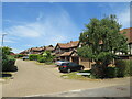
Eastcott Close, Littledown, Bournemouth
Eastcott Close forms part of a modern housing development in Littledown, in the north-eastern suburbs of Bournemouth.
Image: © Malc McDonald
Taken: 21 Jun 2022
0.15 miles
9
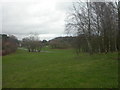
Bournemouth, Littledown Common
The western side of Littledown Common is a public open space, with short grass & clumps of trees; to the east Image, the common has been left natural. Used by pedestrians, joggers, cyclists & children to and from the local schools.
http://www.bournemouth.gov.uk/Library/PDF/Landscape/DRAFT%20WOODLAND%20STRATEGY%2006-2006.pdf
Image: © Mike Faherty
Taken: 12 Dec 2008
0.16 miles
10
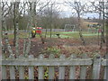
Bournemouth, Littledown Common
Littledown Common has two playgrounds; this one with smaller equipment, and the other with larger, both set amidst pleasant trees.
http://www.bournemouth.gov.uk/Library/PDF/Landscape/DRAFT%20WOODLAND%20STRATEGY%2006-2006.pdf
Image: © Mike Faherty
Taken: 12 Dec 2008
0.16 miles