
IMAGES TAKEN NEAR TO
Bodorgan Road, BOURNEMOUTH, BH2 6NL
Introduction
This page details the photographs taken nearby to Bodorgan Road, BH2 6NL by members of the Geograph project.
The Geograph project started in 2005 with the aim of publishing, organising and preserving representative images for every square kilometre of Great Britain, Ireland and the Isle of Man.

There are currently over 7.5m images from over14,400 individuals and you can help contribute to the project by visiting https://www.geograph.org.uk
Image Map
Images are licensed for reuse under creativecommons.org/licenses/by-sa/2.0
Notes
- Clicking on the map will re-center to the selected point.
- The higher the marker number, the further away the image location is from the centre of the postcode.
Image Listing (366 Images Found)
Images are licensed for reuse under creativecommons.org/licenses/by-sa/2.0
Image
Details
Distance
1
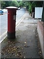
Bournemouth: postbox № BH2 39, Bodorgan Road
A Victorian postbox, one of those built during the period 1879-1887 when the royal cipher was omitted.
During November 2013 it was inspected as part of a routine maintenance programme and its foundations were found to be irreparably rusted. It was therefore replaced by a more modern box: see Image
Image: © Chris Downer
Taken: 10 Jul 2008
0.03 miles
2
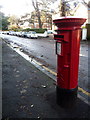
Bournemouth: replacement postbox on Bodorgan Road
Engineers have been doing the rounds inspecting the town centre postboxes over the last couple of months, and have had to replace Image
The fine old Victorian box was found to have rusted away at the foundations and was irreparable. In its place, this Elizabeth II-reign box has been installed.
Image: © Chris Downer
Taken: 30 Dec 2013
0.03 miles
3
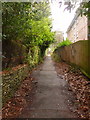
Bournemouth: footpath B16 between Braidley and Bodorgan Roads
Looking up this public footpath from near the Braidley Road end. Immediately behind us, the path splits in two, giving a gentler slope in whichever direction is more appropriate to you.
See Image for the view down the path from the top end, and Image for the diverging paths behind us, with links to further photos in both directions.
Image: © Chris Downer
Taken: 26 Feb 2010
0.04 miles
4
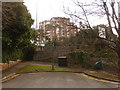
Bournemouth: the end of Bodorgan Road
Bodorgan Road swung to the left here, to come out on Wimborne Road near the top of Richmond Hill, until 1973 when the by-pass was put through. Now, pedestrian access is still available ahead, coming out on Richmond Hill roundabout. See Image
We can see the road signs of the slip-road from the by-pass in the background.
Image: © Chris Downer
Taken: 26 Feb 2010
0.05 miles
5
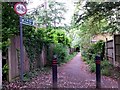
Bournemouth: the top of footpath B16
Looking down this public footpath from Bodorgan Road, heading to Braidley Road. See Image for the uphill view.
Image: © Chris Downer
Taken: 15 Jun 2016
0.06 miles
6
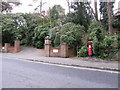
Bournemouth: postbox № BH2 276, Braidley Road
A postbox at the northern end of Braidley Road, trying its best to conceal itself in bushes.
Image: © Chris Downer
Taken: 25 Dec 2008
0.06 miles
7
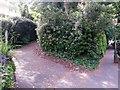
Bournemouth: footpath B16 to Bodorgan Road
Looking up the start of this public footpath from Braidley Road. This is one arm of a Y-shape arrangement, with another path coming up in the opposite direction a short distance ahead.
As can be seen, the first yard or two shares its route with the driveway of one of the houses.
See Image for the view towards us from a little way up the path, and Image for the start of the other path, B17.
Image: © Chris Downer
Taken: 15 Jun 2016
0.06 miles
8
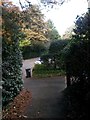
Bournemouth: footpath B16 reaches Braidley Road
The northern/western end of this public footpath from Bodorgan Road, as it arrives on Braidley Road. The course of the path shares a driveway to one of the houses for literally a yard or two at the bottom.
See Image for the view up the path from the road, and Image for the next view on the path behind us, with links to further photos along the route.
Image: © Chris Downer
Taken: 2 Nov 2016
0.07 miles
9
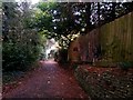
Bournemouth: footpath B16 heads down to Braidley Road
The public footpath from Bodorgan Road has just split, and is seen here dropping down to Braidley Road northward. Another path heads southward to the same road - see Image for the view behind us illustrating the junction.
See Image for the emergence onto the road ahead.
Image: © Chris Downer
Taken: 2 Nov 2016
0.07 miles
10
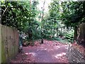
Bournemouth: footpaths B16 and B17 diverge
The public footpath from Bodorgan Road approaches Braidley Road but, just before it does so, splits into a Y-shape. The designation of the main path, B16, continues northbound to the right while path B17 does the southbound job. The carriageway of Braidley Road is just a few yards behind the trees, but still a bit more downhill.
See:
Image for the path heading up to Bodorgan Road behind us;
Image for the continuing path B16, right; and
Image for the view down path B17, left.
Image: © Chris Downer
Taken: 15 Jun 2016
0.07 miles