
IMAGES TAKEN NEAR TO
Baker Road, BOURNEMOUTH, BH11 9JD
Introduction
This page details the photographs taken nearby to Baker Road, BH11 9JD by members of the Geograph project.
The Geograph project started in 2005 with the aim of publishing, organising and preserving representative images for every square kilometre of Great Britain, Ireland and the Isle of Man.

There are currently over 7.5m images from over14,400 individuals and you can help contribute to the project by visiting https://www.geograph.org.uk
Image Map
Images are licensed for reuse under creativecommons.org/licenses/by-sa/2.0
Notes
- Clicking on the map will re-center to the selected point.
- The higher the marker number, the further away the image location is from the centre of the postcode.
Image Listing (106 Images Found)
Images are licensed for reuse under creativecommons.org/licenses/by-sa/2.0
Image
Details
Distance
1
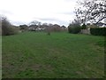
Bear Cross: Baker Road Open Space
Looking east across this small patch of public open space enclosed by houses in Anstey Road (ahead), Anchor Road (to right), and Baker Road (left and behind us).
It is accessed by two short public footpaths, one just behind us at the southwest corner and one at the northeast, far left.
See Image for the view towards the footpath to our right, with links to further photos on that path to Anchor Road; and Image for the view towards us from near the distant tree, with links to photos of the corresponding path onto Baker Road.
Image: © Chris Downer
Taken: 18 Mar 2017
0.03 miles
2
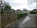
Kinson: footpath E21 reaches Baker Road
This public footpath from Wimborne Road via Anstey Close approaches its destination here by sharing the driveway for the Scout hut. There is a collection of bird tables in the garden immediately to our left.
See Image for the view along the driveway from the road ahead, and Image for the next view on the path behind us, with links to further photos along the route.
Image: © Chris Downer
Taken: 18 Mar 2017
0.03 miles
3
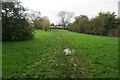
Turf Zone "NoAnchor"
A green off Baker Road, Bear Cross.
Image: © Ian S
Taken: 15 Nov 2022
0.03 miles
4
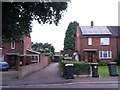
Kinson: footpath E21 to Anstey Close and Wimborne Road
Looking across Baker Road, along the driveway to the Scout hut which forms the start of a public footpath to Wimborne Road via Anstey Close.
See Image] for the view towards us from midway along the driveway, with links to further photos along the route.
Image: © Chris Downer
Taken: 30 Jun 2016
0.04 miles
5
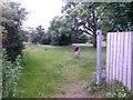
Kinson: footpath E20 enters open green space
Looking through the gateway in Image] at the end of this short public footpath which leads to the open space in front of us.
See Image for a view a bit further in, and links to further pictures as we come out eventually in Anchor Road.
Image: © Chris Downer
Taken: 30 Jun 2016
0.04 miles
6
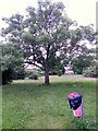
Kinson: tree in open space behind Baker Road
Looking diagonally across this little green space between Baker and Anchor Roads.
See Image for links back to the public right of way that has brought us here from Baker Road, and Image for a view towards us from the far end of the open space, with links to photos along the similar public footpath to Anchor Road.
Image: © Chris Downer
Taken: 30 Jun 2016
0.04 miles
7
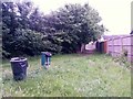
Kinson: looking back along footpath E11
A view back along Image] - we can't see Anchor Road because of a kink midway along the path.
See Image for the view towards us from the path ahead, and Image for a view to our left across the open space, with links to follow the route through to Baker Road. (It is only the two approach paths, and not the open space itself, that are designated as public rights of way.)
Image: © Chris Downer
Taken: 30 Jun 2016
0.04 miles
8
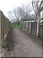
Bear Cross: footpath E11 approaches the open space
This short public footpath leads from Anchor Road to the Baker Road Open Space, a small public space surrounded by back gardens of Baker, Anchor and Anstey Roads. There is a through route across the open space to a similar public footpath leading onto Baker Road.
See Image for the view from Anchor Road behind us, and Image for the view towards us from ahead, with links to further photos across the open space to Baker Road.
Image: © Chris Downer
Taken: 18 Mar 2017
0.04 miles
9
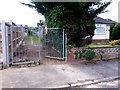
Kinson: footpath E20 from Baker Road into a green open space
These rather serious looking gates are across a public footpath into public open space between Baker and Anchor Roads. It is only the approach path that is officially a public right of way, along with the similar one at the other end in Anchor Road.
Nevertheless, it is usable as a through route, so see Image for the next picture and links to further photos all the way to Anchor Road.
Image: © Chris Downer
Taken: 30 Jun 2016
0.05 miles
10
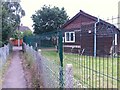
Kinson: footpath E21 passes the Scout hut
Looking along this public footpath as it heads for Baker Road, passing the Scout hut as it does so.
See Image for the next picture along the path ahead, and Image] for the next picture behind us.
Image: © Chris Downer
Taken: 30 Jun 2016
0.05 miles