IMAGES TAKEN NEAR TO
Serel Drive, WELLS, BA5 2DQ
Introduction
This page details the photographs taken nearby to Serel Drive, BA5 2DQ by members of the Geograph project.
The Geograph project started in 2005 with the aim of publishing, organising and preserving representative images for every square kilometre of Great Britain, Ireland and the Isle of Man.

There are currently over 7.5m images from over14,400 individuals and you can help contribute to the project by visiting https://www.geograph.org.uk
Image Map
Images are licensed for reuse under creativecommons.org/licenses/by-sa/2.0
Notes
- Clicking on the map will re-center to the selected point.
- The higher the marker number, the further away the image location is from the centre of the postcode.
Image Listing (16 Images Found)
Images are licensed for reuse under creativecommons.org/licenses/by-sa/2.0
Image
Details
Distance
1
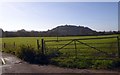
Gate with barbed wire, Burcott Lane
The barbed wire along the top bar is, presumably, to deter climbing over the gate to get to the footpath beyond. A side gate is provided for walkers. Beyond is Hay Hill
Image: © David Smith
Taken: 17 Nov 2017
0.08 miles
2
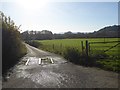
Road to Wells sewage works, off Burcott Lane
Image: © David Smith
Taken: 17 Nov 2017
0.08 miles
3
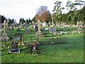
Wells Cemetery
Wells Cemetery is shown on the 1940's map.
Image: © Graham Richards
Taken: 17 Dec 2005
0.08 miles
4
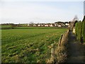
Bubwith Walk
This walkway is at the back of the houses in Martin's Close. I lived in one of the houses throughout my school years, and used to play in the field on the left. The estate in the distance was not there at that time.
Image: © Sharon Loxton
Taken: 26 Jan 2008
0.09 miles
5
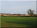
The western edge of Wells
A view east towards the houses on the estate on the westernmost edge of Wells. Taken from the footpath which runs around the sewage works.
Image: © Sharon Loxton
Taken: 26 Jan 2008
0.11 miles
6
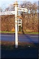
Direction Sign - Signpost on the A371 at Haybridge
Pyramid finial - 4 arms, 1 missing; Somerset SCC pyramid by the A371, in parish of Wells (Mendip District), in Haybridge in the centre of the Y junction of the A371 and the B3139 Elm Close.
surveyed
Milestone Society National ID: SO_ST5345
Image: © Milestone Society
Taken: Unknown
0.15 miles

8
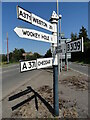
Direction Sign - Signpost on the A371 at Haybridge
Located in Haybridge in the centre of the Y junction of the A371 and the B3139 Elm Close. Wells parish. 4 arms and pyramid finial. The Weston arm was lost some time before July 2011 but has now been replaced. See https://www.geograph.org.uk/photo/6056199 for an older photo.
Milestone Society National ID: SO_ST5345
Image: © Roadside Relics
Taken: 29 Jul 2024
0.15 miles
9
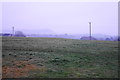
Field by Elm Close
This field on slightly raised land on the western side of Wells would normally give a better view than this, conditions allowing. The lump of Launcherley Hill is still visible on this misty winter afternoon.
Image: © Bill Boaden
Taken: 30 Dec 2016
0.16 miles